


![]()
You are here
Barskoon pass.
Trip from Issyk-Kul lake to Pass Barskoon.
"Climbing the Barskaun Pass, I hoped for warm weather and dressed lightly, but soon the snowy peaks that had opened up during our departure closed again, and, having risen a little higher than a large hump near Keregetas, we found ourselves in clouds, i.e. in fog, with a fine snow hoarfrost; at times the clouds rose, it snowed, there were light gusts of wind, but it was still warm; not cold even on the already frozen saz that formed the top of the pass."
"Travel through the Turkestan region and exploration of the mountainous country of Tien Shan." N. A. Severtsov. 1873.
Familiarization tour to Karakol and Naryn.
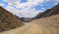
High-mountain Barskoon Pass is located at an altitude of 3754 meters above sea level, is located in main ridge of Terskey Ala-Too Range on watershed isthmus between Issyk-Kul Basin and Arabel Valley, in upper reaches of river of same name in Jety-Oguz District of Issyk-Kul Region.
From the northern side of the Barskoon Pass, the Barskoon River originates, 62 kilometers long, which flows into the Barskoon Bay on the southern coast of Lake Issyk-Kul. From the south-eastern side of the Barskoon Pass, the Arabel-Su River originates, 41 kilometers long, which is one of the rivers that originate the Naryn River.
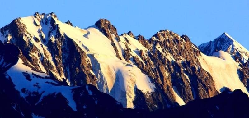
From the north-eastern side of the pass, there are nearby, nameless peaks with an altitude of 4520 and 4614.4 meters above sea level. On the western side of the pass there are nearby, nameless peaks 4386 and 4164 meters above sea level.
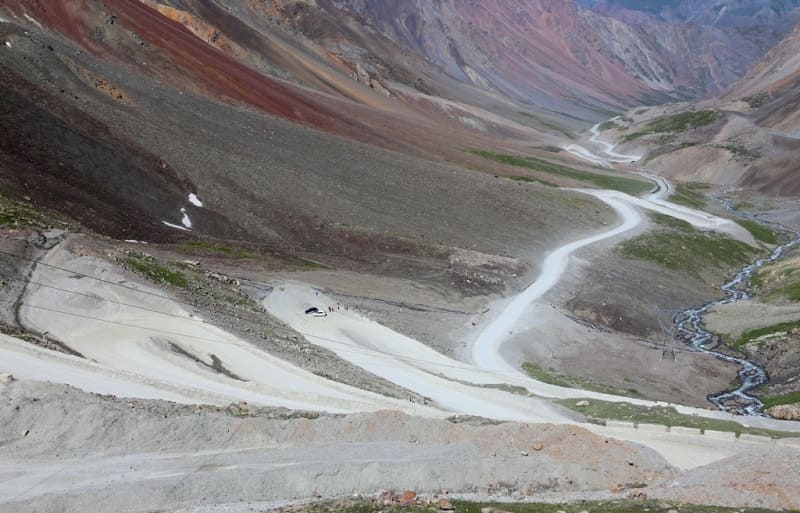
The northern slope of the pass is steep and short, breaking off to the southern shore of Lake Issyk-Kul, the southern slope is low and gentle, which passes into the Arabel Valley located on the syrts plateau between the southern slopes of the Terskey Ala-Too ridge and the northern slopes of the Sook ridge.
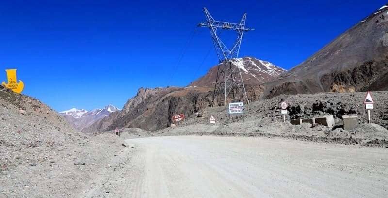
A highway connecting the syrts of the Inner Tien-Shan with the Issyk-Kul Valley and a high-voltage power line pass through the Barskoon Pass. The A 364 highway takes you to the Kumtor mine, the Karasay border post, the Uchkoshkon deposit, and through the Ashu-Suu Pass you can get to the Uzengegush River valley. 600 meters to the southeast of the Barskoon Pass, to the right of the road, is a small lake Barskoon, from which the Arabel-Su River flows. 2.4 kilometers to the southeast, at an altitude of 3779.1 meters above sea level, is the high-mountain lake Dzhashyl-Kel West.
8 kilometers to the southwest of the pass is the dominant mountain Chymchyk, 4467.2 meters above sea level. The road that connects the southern shore of Lake Issyk-Kul with the Kumtor mine, which is located in the western part of the Ak-Shyirak ridge, the Karasai border post, the sources of the Naryn River, the remote and high-mountain village of Uch-Koshon located at an altitude of 3,134 meters above sea level, the Ashusu Pass at an altitude of 3,840 meters above sea level, through which the road continues to the valleys of the Uzengegush and Aksai rivers in the Naryn region, passes through the pass.
The road through the Barskoon Pass is open all year round. A high-voltage power line passes through the Barskoon Pass.
Geographic coordinates of Barskoon Pass: N41°53'38.77" E77°41'26.28"


Author and photos by:
Alexander Petrov.