


![]()
You are here
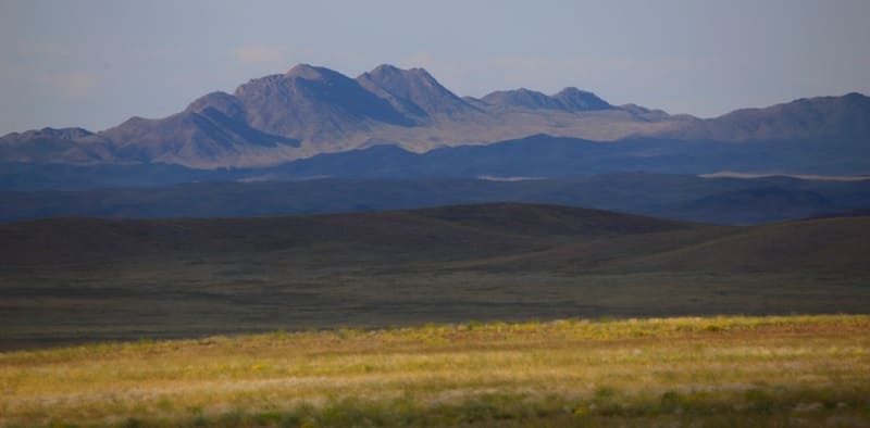
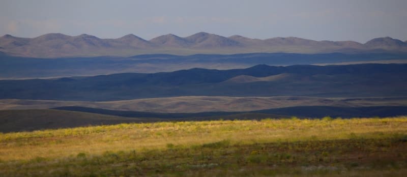
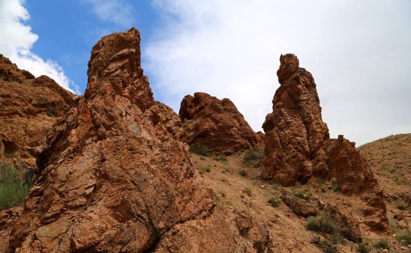
Anyrakai mountains.

Mountains in Kazakhstan.
"When traveling, the main thing is not to forget that the meaning is in the journey itself, and not at its end. If you are in too much of a hurry, you will miss the goal for which you are traveling"
F. Lamenne.
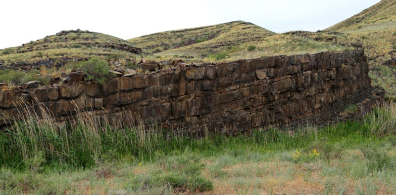
Mountains in Zhambyl region.
Anyrakay mountains are located at an altitude of 1000 to 1242.6 meters above sea level, are located in the Kordai district in the east of the Zhambyl region. In the west, the mountain range of the Anyrakai Mountains borders on the small mountains of Tulkili and Ketpen-Kaldy.
In the southeastern part of Anyrakay it borders on the Zunbulak and Karykyr mountains. The most south-eastern part of the mountains ends at the watershed of Sarybulak, which runs from the south to the north, here the administrative border of the Zhambyl and Almaty regions passes along the riverbed.
The most dominant peak of the mountains is Mount Tamlayshoky, 1242.6 m. a. s. l., which is located in the system of the same name of small mountains adjoining from the south. In the northern part of the mountains, to the west of the Kaskyrsay valley, the second highest peak is 1091 meters above sea level.
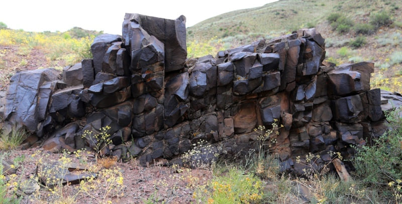
The Anyrakai Mountains are the highest in the Chu-Ili Mountains, they are composed of the most ancient Proterozoic rocks, which are characterized by high resistance to denudation and erosion processes. The ancient quartzite and shale strata compose the main territory and watershed spaces of the mountains and are characterized by a steep relief with deep short valleys.
The strength of the rocks determines the relatively slow development of the hydrographic network in comparison with adjacent areas composed of less durable rocks of the effusive-sedimentary strata of the Ordovician and Devonian. The latter have a softly outlined relief, which is represented mainly by ridges.
This clearly represents the pattern of the hydrographic network of the northern slopes of the Anyrakai Mountains. The direction of the valleys, in addition to the slope of the terrain, is also determined by the system of tectonic faults. The satellite image shows that the formation of the Anyrakai Mountains, this uplifted neotectonic block, is due to a system of faults along which different amplitudes of movements occur, the absolute value of which increases towards the watersheds.
The faults have two different directions: the main one is northwestern, and the secondary one is submeridional, characteristic of feathering faults. They are relatively short, but they influence the formation of a hydro-graphic network.
The main valleys of the region are confined to two such faults.
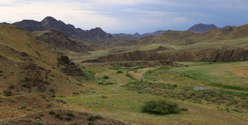
Anyrakai mountains have two large valleys, which, as it were, frame the main part of the massif. In the western part is the valley of the river Kopala, and in the east - the river Sarybulak. In this interfluve area, a large number of archaeological and historical monuments are concentrated on a relatively small area.
The natural landmark of the Kopala River has a large catchment area, originates from the main Chu-Ili watershed in the Kulzhabasy mountains and has a length of more than 80 kilometers, while the main part of the Anyrakai valleys belongs to the local watershed.
In its upper part, the Kopala valley is relatively wide, with steep meanders, and abounds in places convenient for long-term human habitation. Crossing the Anyrakai Mountains, the river cuts into the foothill plain, forming a long, difficult and steep canyon.
he length of this section is more than 30 kilometers, the height of the cliffs varies from two meters in the lowest part to 12 - 14 meters in the foothills. One of the important features of the area is the existence of numerous salt marshes and small fresh lakes and wetlands that dry up in summer, which owe their origin to groundwater.
Along the northern foothills of the Anyrakai Mountains there is a plume of alluvial fans, composed of coarse-grained material - boulders, pebbles with sandy-loamy filler. This highly porous material of the plume of alluvial fans accumulates water in spring and autumn, keeping it during the summer.
Along the periphery of the plume of alluvial fans in the most low areas during the summer, it comes to the surface in the form of springs. Springs in this area are noted at the level of 630 - 650 meters above sea level. The soils of the foothill plains and intermountain valleys in the region of the Anyrakai Mountains are light northern sierozems (low-carbonate), light southern sierozems (typical, in some places typical solonetzic-alkaline).
Geographic coordinates of Mount Anyrakay: N43°59'46 E75°08'54
Authority:
Alexander Petrov.
"Anyrakay Triangle Historical-Geographical Area and Chronicle of the Great Battle". I.V. Erofeeva, B.Zh. Aubekerov, A.E. Rogozhinsky, B.N. Kaldybekov, B.T. Zhanaev, L.L. Kuznetsova, R.D. Sala, S.A. Nigmatova, J.M.P. Deom. Almaty, 2008. "Dyke Press".
Photos by:
Alexander Petrov.