


![]()
You are here
Ancient settlement Karatobe.
Tours in Kazakhstan.
"History should not overstep the limits of truth, and truth alone is enough for honest deeds."
Pliny the Younger.
Tours to historical-cultural monuments of Turkestan.
The Karatobe settlement is located on a hill 213.6 meters above sea level, 5 kilometers west of the railway junction No. 30, 3.4 kilometers southeast of the Sauran settlement, 23.1 kilometers southwest of the Yntaly village, 44.3 kilometers north-west of the city of Turkestan, subordinate to the city administration of Kentau, in the Turkestan region.
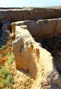
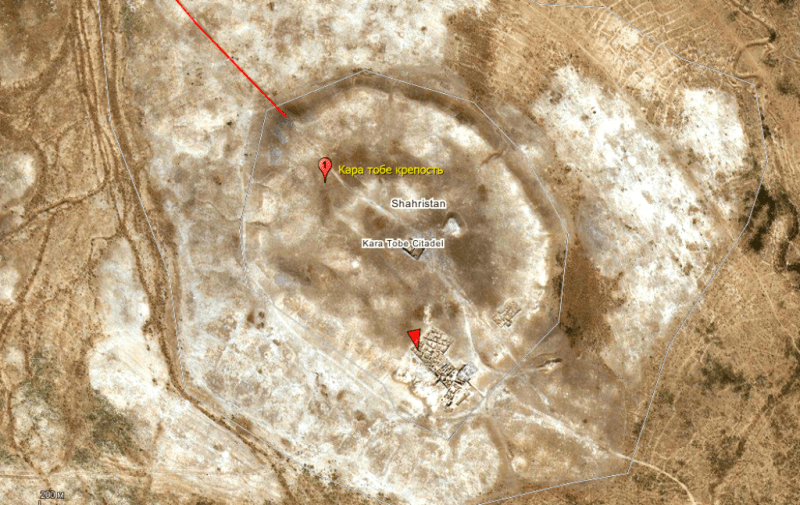
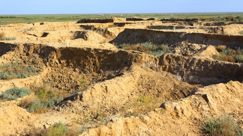
The settlement dates back to the IVth - Vth - XIIth - XIVth centuries, it is a large three-level hill, which in shape resembles a pentagonal heraldic shield. The sides of the pentagon have the following dimensions: north-west side - 250 meters, north side - 165 meters, south-west side - 180 meters, south-east side - 280 meters and east side - 180 meters.
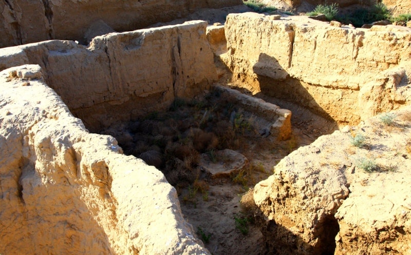
The citadel of the city is located in the northwestern part of the settlement. Its north side is 70 meters, the north-west side is 110 meters, the south-west side is 160 meters, the north-east side is 160 meters, and the south-east side is 60 meters.
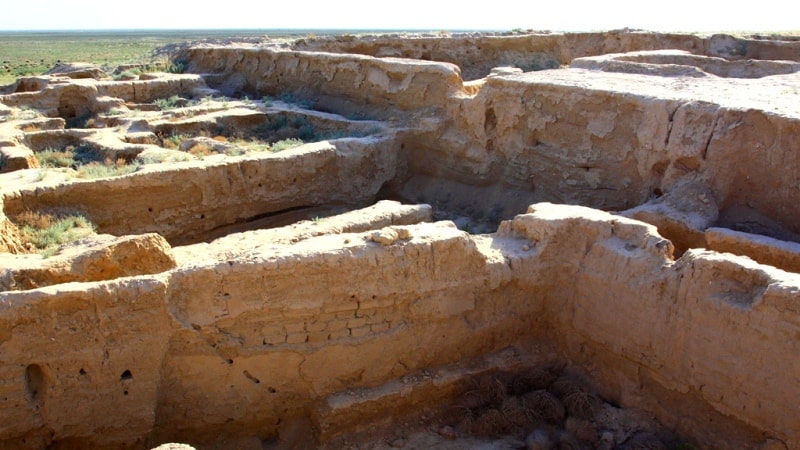
The base of the citadel is rectangular, 11 meters high. On the northern wall, there is a 15-meter-high tower, its base is 20 meters in diameter. The citadel is located at an altitude of 213.6 meters above sea level, while the shakhristan is at an altitude of 209 meters.
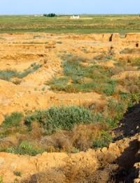
At the northern, northwestern, southwestern and eastern corners, the foundations of fortification towers have been preserved. The rabad districts of the settlement can be clearly traced around the main hill. The total area of rabad is 18.2 hectares, shahristan - 11.2 hectares, citadel - 3.5 hectares.
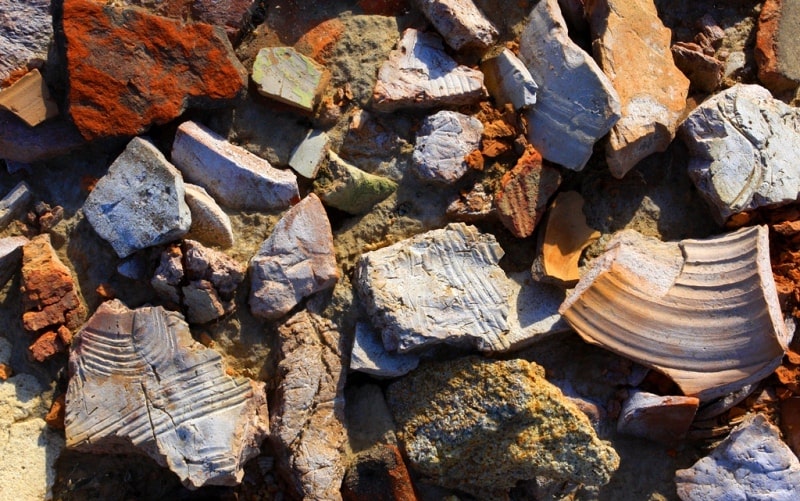
Thus, the total area of the settlement, including rabad, is more than 30 hectares. The first description of this settlement appeared in the works of YUKE (A.N.Bernshtam) in 1947. This expedition took the topographic plan of the settlement and, based on the analysis of the lifting material, dated the settlement to the VIth - XIIIth centuries.
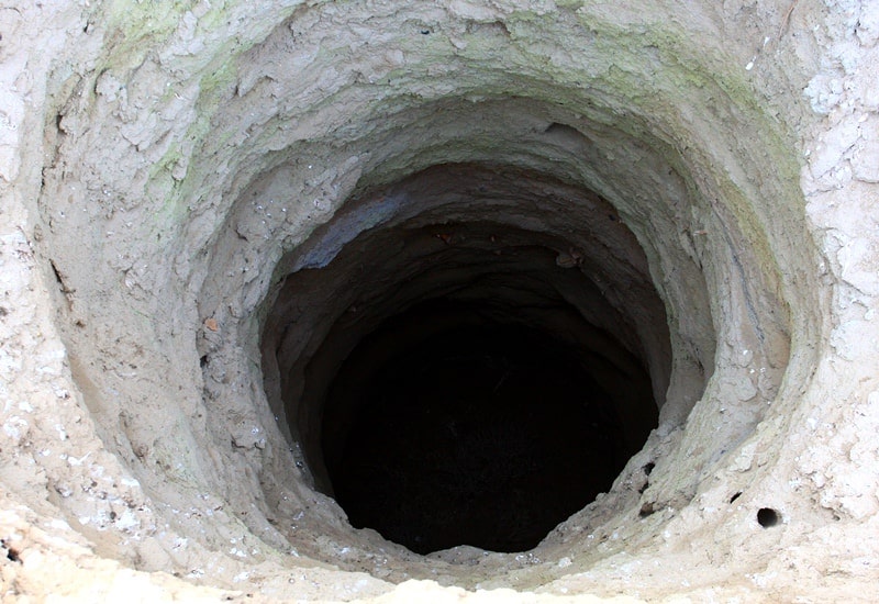
In 1986, an expedition of the Institute of Archeology led by K. Baipakov carried out archaeological research on the sites of Sauran and Karatobe. In 2003, a detachment of the Turkestan archaeological expedition led by M. Tuyakbayev laid the first exploration stratigraphic pit.
Archaeological research continued in 2005 - 2008. The settlement of Karatobe under number 634 is registered in the "Code of monuments of history and culture of Kazakhstan. South Kazakhstan region "and is taken under state protection.
Geographic coordinates of the settlement of Karatobe (pre-Mongol Sauran): N43 ° 29'14.37 "E67 ° 46'44.68"
Authority:
http://azretsultan.kz/rus/gorodishhe-karatobe-sauran-iv-v-hiv-vv/
Photos by
Alexander Petrov.