


![]()
You are here
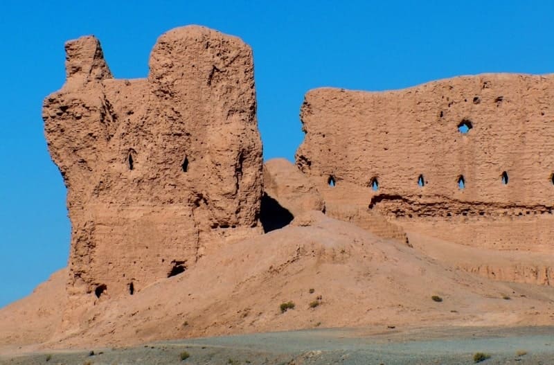
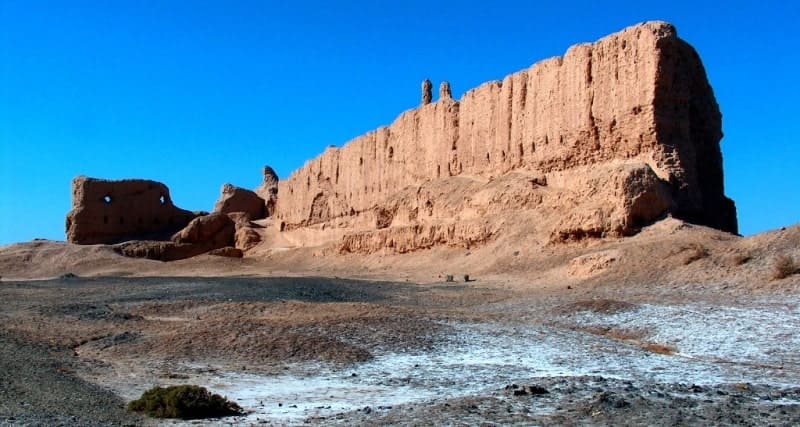
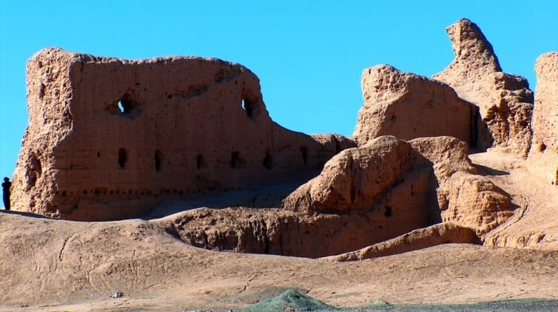
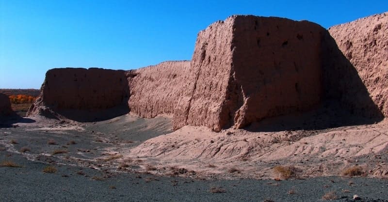
Ancient settlement Gyaur kala (Sultanuizdag).
Tours from Khiva to Karkalpakstan.
"Untouched for centuries, an endless double row of towers that were far advanced forward, connected by rising ledges by a pre-barrier, and the fifteen-meter plane of gigantic walls, overwhelming with its full of hidden power, overwhelmed by the motionless waves of the ridges of the dunes, were painted in the evening sky."
S.P. Tolstov. "Along the ancient deltas of the Oxus and Yaxart." Eastern literature.
Architectural monuments of Karkalpakstan.
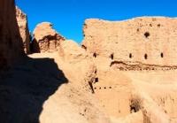
Settlement of Gyaur Kala (Sultanuizdag) is located at an altitude of 90 meters above sea level, located on right (eastern) bank of Amu Darya River, in southwestern part of Kekiliktau Mountains and in eastern part of Sultan-Uvays ridge, 1.4 kilometers south of village Karatau, 18.4 kilometers east and slightly south of village of Mangit, 9.7 kilometers northeast of village of Kuyuk-Kupyyr, 7.1 kilometers northwest of settlement of Dzhanpyk Kala in Karauzyak region of Republic of Karakalpakstan.
The ancient settlement of Gyaur kala (Sultanuizdag) dates back to the IInd - IVth centuries BC. To avoid confusion with Gyaur Kala near the settlement of Mizdahkan (Khodjeyli district of the Republic of Karakalpakstan), this monument is often called Gyaur Kala Sultanuizdag.
At the same time, it is adjacent to the northern edge of the buffer zone of the Badaytoga nature reserve. The name Gyaur-Kala probably originates from the times of the Arabs, who call all non-Muslims "Geuhirs". Over time, the word began to be pronounced as "Gyaur".
The purpose of the construction of this fortress was to be able to protect and control the important trade routes of the Amu Darya during the transition to the southern borders of Khorezm. There is ample evidence that Khorezm was at that time an important link on a trade route that stretched from India in the east to the Black Sea in the west, and from Persia and Mesopotamia in the southwest.
The fortress continued to be used until the end of the Kushan Empire until the IIIrd century AD. The ancient settlement Gyaur Kala was first surveyed by the KhAEE of the USSR Academy of Sciences in 1940. The plan of the fortress was removed, sketches were made.
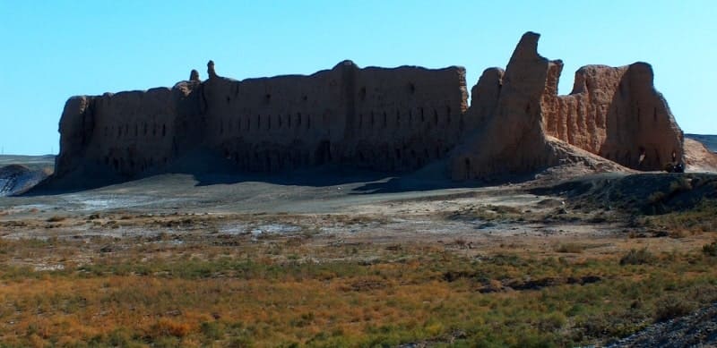
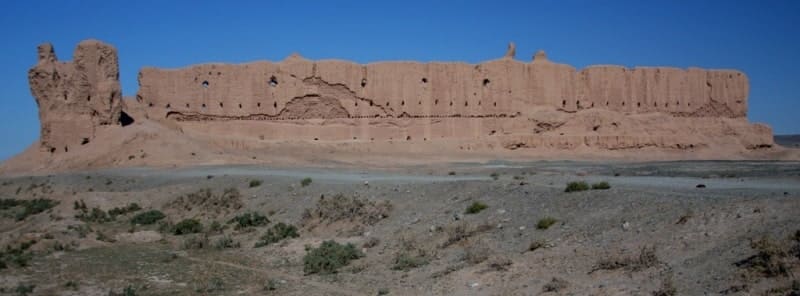
In 1951 - 1952, a group of expedition employees made additional fixation of the monument. The settlement has sub-triangular outlines in plan and is elongated from north to south. The length of the northern wall is about 20 meters, in the eastern part, the wall recedes 50 meters to the south, and then continues 50 meters in the original direction.
The length of the eastern wall is 450 meters, the western wall, the southern part of which was washed away by the Amu Darya, has survived for 400 meters and stretches along the coast for 100 meters from the river.
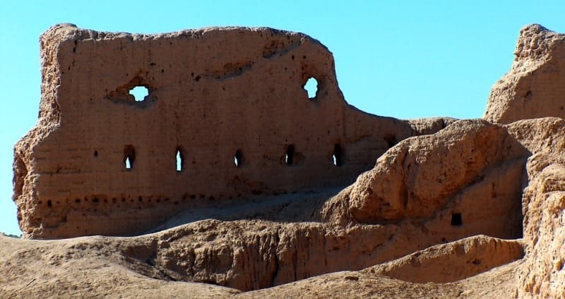
The settlement was surrounded by a fortress wall cut by two rows of loopholes and enclosing a two-story shooting gallery. The walls were reinforced with towers 20 meters apart. Excavations of Gyaur kala yielded an insignificant number of household finds, which is explained by the almost complete absence of a cultural layer in the excavated premises and on the rest of the site.
The poverty of the cultural layer serves as an indirect indication of the short-term use of the fortress. Along with ceramics, a terracotta figurine of an elephant and a sculptural image of a man's head were found on the monument.
Currently, the monument is a Historical and Archaeological Site for cultural and tourist trips. The studies carried out here have established that the communication between the arrow of the galleries and the towers on each side of the fortification was carried out in different ways.
The upper shooting gallery and the upper chambers of the tower on the southwestern wall of the fortification were not communicated, they got there from the lower chamber through hatches (Rapoport, Trudnovskaya, 1958).
The southeastern upper shooting gallery and the upper chambers of the tower were connected through a passage, the lower tiers of the tower were monolithic. The nature of the fortification systems makes it likely that Gyaur Kala is the remains of a fortress that existed in the Kanpoi period.
Geographic coordinates of the ancient settlement Gyaur kala (Sultanuizdag): N42°04'50 E60°16'31
Authority:
Dospanov October. “Improving the efficiency and sustainability of the functioning of the created Nizhne-Amudarya State Biosphere Reserve”. Nukus - Tashkent. 2013.
http://cheloveknauka.com/fortifikatsiya-drevnego-horezma-vi-v-do-n-e-iv-v-n#ixzz6rM3ZnHH7
Photos by:
Alexander Petrov.