


![]()
You are here
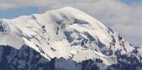
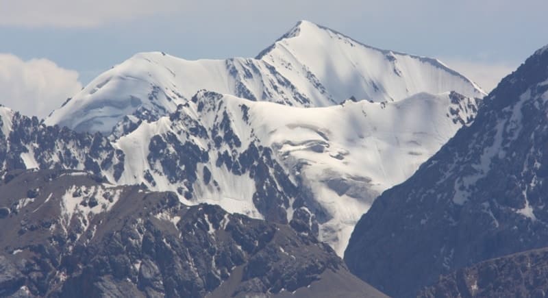
Ak-Shiyrak ridge.
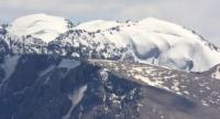
Automobile travel on Ak-Shiyrak.
"Ak-Shiyryak Ridge serves as a watershed between the Syr Darya (Naryn) and Saryjas river systems, which carry their waters into the Tarim River and Lake Lob-Nor (in China). Most of the peaks exceed 5000 m. Only one of them - Sary-Ter Peak (5200 m) - was climbed in 1932 by our group (A. A. and K. S. Letavet and V. A. Engelhardt) and in subsequent years - by several groups of observatory workers. The highest point of this ridge - Koyandu Peak (about 5700 m) - is located in the southeastern part of the ridge at the source of the river of the same name. However, no one has observed this peak up close to this day, and the approaches to it are unknown."
"Central Tien-Shan". A. Letavet. 1937.
"Petrov mapped a short but powerful ridge, Ak-Shyirak (up to 5125 m), and discovered a number of huge glaciers there; the largest (about 17 km) was named after him. He also found out that the Naryn River originates from the Petrov Glacier"
Magidovich I. P. "Essays on History of Geographical Discoveries".
Tours on Ak-Shiyrak in mountains Central Tien-Shan.
Ak-Shyirak ridge is second largest glaciated mountain range located between southern slopes of Terskey Ala-Too ridge and northern slopes of Kokshaal-Too ridge. In east, ridge borders on western slopes of Kuilyu-Too ridge. It is located in the upper reaches of Taragai rivers in north, Irtash and Aktash in the east, Karasai and Barlabas in south, in Jety-Oguz and Aksu districts of Issyk-Kul region.
Translated from Kyrgyz, the meaning of the word "shyirak" is shin. Ak-Shyirak (in Kyrgyz Ak-Shyirak) is a phrase usually used in relation to sheep and meaning "white-legged". The Ak-Shyirak Ridge is a watershed between the upper reaches of the Naryn and the rivers of the Sary-Dzhaz basin (Uch-Kol, etc.).
The length from the southwest to the northeast is 80 kilometers and the width in the central part is 34 kilometers.
Highest point of ridge is an unnamed peak 5125.5 m. a. s. l. located in the northeastern part of the massif in the upper reaches of the Djamansu River.
Second highest peak is an unnamed peak 5100 meters above sea level, located in the upper reaches of the vast Djamansu South glacier.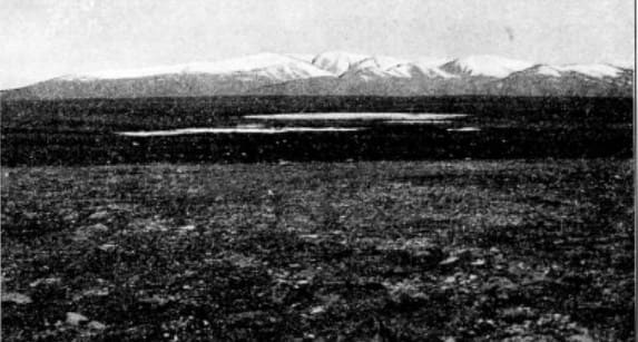
Third peak is the Council of People's Commissars of Kyrgyzstan (old name Sary-Tor) 4946.9 m. a. s. l. located in the main ridge of the ridge in the upper reaches of the Sarytor South and North glaciers and the Karasai glacier.
The snow line is located at an altitude of 4100 m. a. s. l. - the western slope, 4500 meters above sea level - the southern slope, where the influence of moist air masses brought from the Issyk-Kul basin through the Terskey Ala-Too passes is more noticeable, and rises to 4500 - 4550 m. a. s. l. in the east of Ak-Shyirak.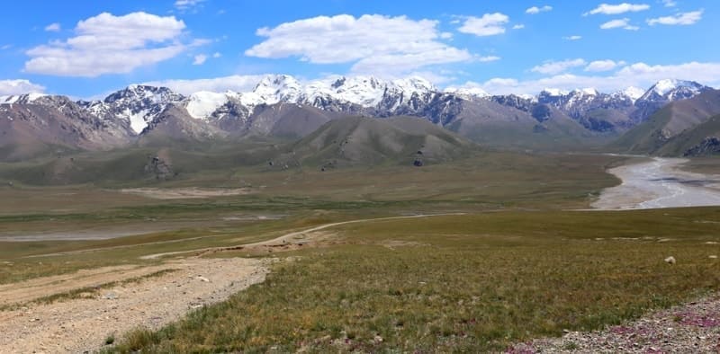
Subnival and glacial-nival landscapes predominate. It is divided by the valleys of the Kara-Sai, Kaindy and Jaman-Su rivers into the Northern, Central and Southern ridges connected by bridges. The latter continues as a spur. Altitude changes from 3000 to 4700 m. a. s. l., there are 6 passes above 4800 m. a. s. l.
The interior of the massif has a typical alpine appearance with narrow rocky ridges separating vast firn fields of valley glaciers, often connected to each other through gentle passes. Ak-Shyirak is one of the largest centers of modern glaciation in the Tien-Shan mountains, over 150 glaciers with a total area of over 430 square kilometers.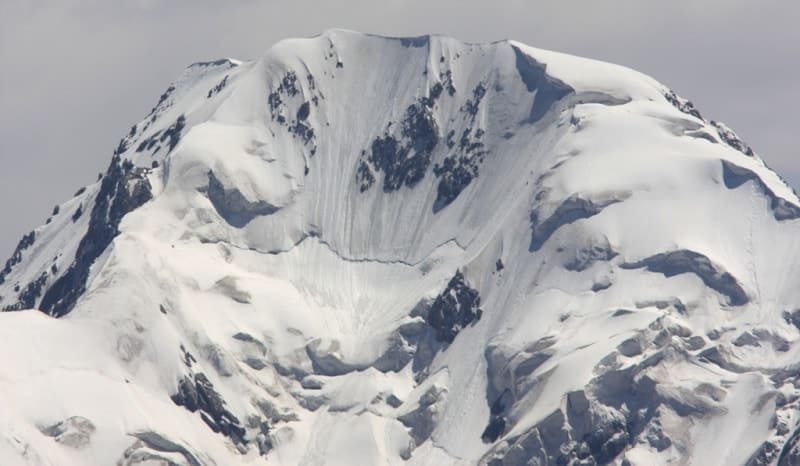
Ak-Shyirak is one of the most compact nodes of the Tien-Shan glaciation, about 46% of its area is covered with glaciers. The largest Petrov glacier, which gives rise to the Naryn River. Between the northern and middle ridges lies a deep longitudinal valley, in the western part of which is the Petrov Glacier (its length is 13.6 kilometers, it is the third largest glacier of Kyrgyz Tien-Shan.
In the eastern part there are glaciers of the Jaman-Su river basin. The Jaman-Su glacier is over 10 kilometers long. Glaciers lie between the middle and southern ridges: from the western part of Kara-Sai Severny (more than 10 kilometers long), and from the eastern part - Kaindy (more than 8 kilometers long).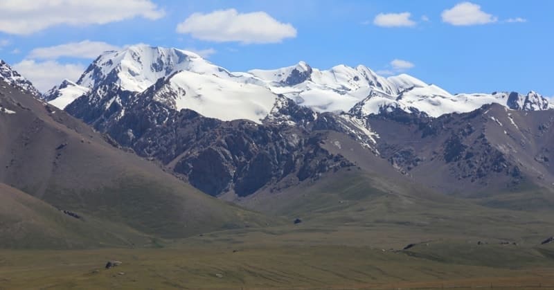
The tongues of glaciers lie at altitudes of 3700 - 4100 m. a. s. l., depending on the exposure of the slopes. The relief of the inner part of the Ak-Shyirak massif has a typical alpine appearance - narrow rocky watersheds, steep walls, sharp peaks and ridges.
The latter, due to the steepness of their slopes, are often devoid of ice and firn cover, even if they rise above the snow line. Many valley glaciers also have an Alpine “appearance”. The main ridges of the Ak-Shyirak massif have a latitudinal strike (from west-southwest to east-southeast).
Ak-Shyirak is separated from Terskey Ala-Too by syrts - alpine sometimes slightly swampy plains, located at an altitude of mainly 3700 - 3900 m. a. s. l., i.e. the array rises above the syrts by 1000 - 1200 meters. Over 60 passes are known. The easiest way to cross the ridge: Petrov passes 4370 m. a. s. l., Koyandy (Koyonduu), 4300 m. a. s. l.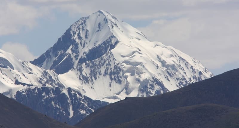
The watershed of two great rivers of Central Asia, the Tarim (an endorheic basin in China, in the Takla-Makan desert) and the Syr Darya (in the upper reaches called the Naryn, which flows into the Aral Sea), runs along these syrts and along the Ak-Shyirak itself.
The rivers flowing from Ak-Shyirak to the east flow into the Saryjaz and Tarim basins, the western rivers belong to the Naryn and Syrdarya basins. Ak-Shyirak is also separated from the Jetim-Bel massif (height up to 4627 m. a. s. l.), located to the west of it and from the Borkoldoy ridge (height up to 5170 m. a. s. l.), located south of Ak-Shyirak.
To the east of Ak-Shyirak there is another mountain range comparable to Ak-Shyirak in size and height - this is Kuilu (or Kyoolyuu, the highest point is the peak of the Constitution 5281 m. a. s. l., earlier this peak was called the peak of the Soviet Constitution, and before that - Stalin's Constitution).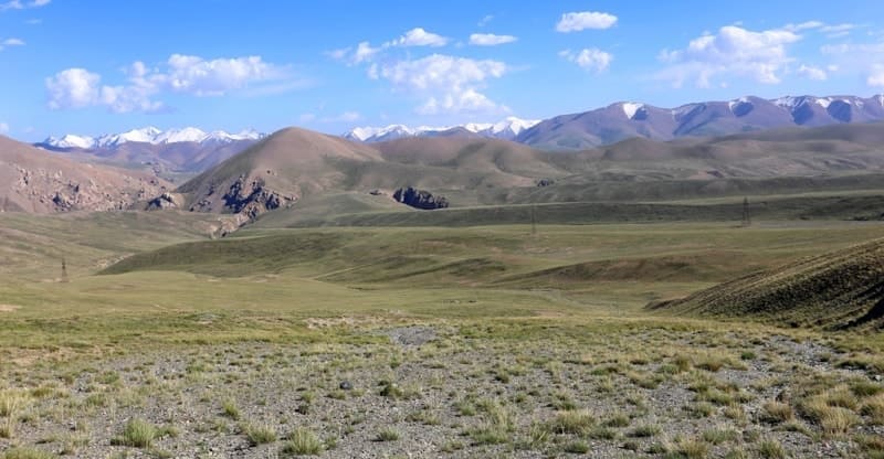
The Kuilyu and Ak-Shyirak massifs are separated by the Sarychat River (in the lower reaches - Irtash or Uch-Kel), the right tributary of the Sarydzhaz. The eastern outskirts of Ak-Shyirak fall more steeply into the gorges of the rivers of the Sarydzhaz basin, the glaciers here have the opportunity to descend lower than in the western part of the massif (the tongue of the Jaman-Su glacier ends at an altitude of 3545 m. a. s. l.).
The climate of the Ak-Shyirak mountain range is sharply continental, dry and extremely harsh - in October on the syrts, frosts reach - 20C, and in winter the temperature can drop to -50C. The annual amount of precipitation is 700 mm, the largest amount of precipitation falls in spring and early summer, the least - zama.
The average temperature in winter is -16°С, in spring and autumn - - 7°С, in June - + 2°С, in July and August - + 4°С and in September - + 0.5°С. Here, on the syrts at an altitude of 3700 m, the Tien Shan weather station is located. Closer to the lake, located below the end of the Petrov Glacier, is the Kyrgyz gold mining plant "Kumtor".
The area around this mine is carefully guarded.
Geographical coordinates of Akshiyrak ridge: N41°51'10 E78°17'12
Authority:
Book "Soviet Encyclopedia". Climbing regions of Kyrgyzstan, guide, author Vladimir Komissarov. Bishkek, 2010.
Alexander Petrov.
Photos by:
Alexander Petrov.