


![]()
You are here
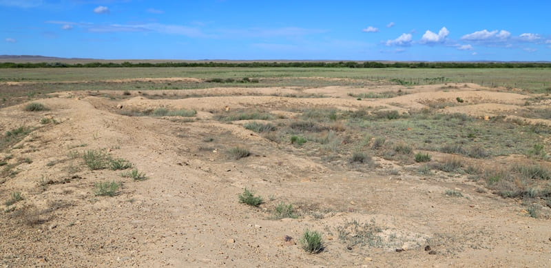
Ancient settlement Khan-Orda in Ulytau.

Photo tours to historical monuments of Ulytau.
"The days would not come when your son is a slave, and your daughter is a slave. The days would not come when the bird of happiness leaves us."
"The last words of Ospan batyr".
Photos of monuments of Ulytau.
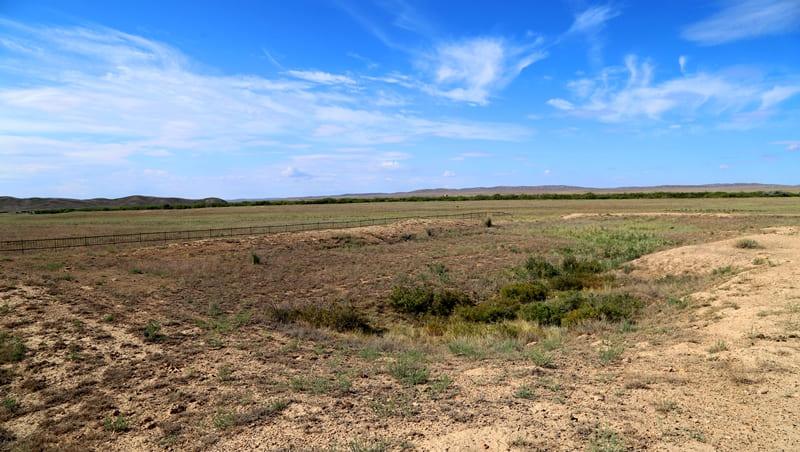
Settlement of Khan-Ordasy is located at an altitude of 438 meters above sea level, located 393 meters from right bank of Kara-Kengir River, 296 meters from mouth of (left) eastern tributary Uronasay into Kara-Kengir River, 3.7 kilometers to south- east of village of Kokolen, 19.3 kilometers northwest of village of Malshybay and 3.2 kilometers northeast of Duzen mausoleum (Duzan Sandybay necropolis) in Ulytau district of region of same name.
“For the first time, the monument was surveyed by the Central Kazakhstan complex archaeological expedition led by academician A.Kh. Margulan. The expedition compiled a description and a plan of the monument. Based on the analysis of the topography of the monument and the study of lifting ceramic material, the settlement was dated to the medieval period.
|In subsequent years, a separate detachment of the New Building Expedition at the Khan-Ordasy settlement laid stratigraphic pits on the citadel wall and the fortress wall, gave a description of the topography, and obtained ceramic material.
Based on the study of planigraphy at the present stage of research, the settlement of Khan-Ordasy belongs to the type - town-rate.
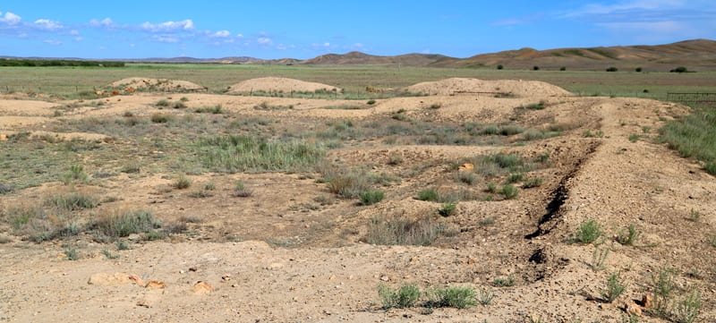
The mound stands out for its main planigraphic feature - the presence of a citadel. The citadel of the settlement is a three-chambered structure attached to the settlement on both sides and separated from the inside by a moat and a rampart. On the southern corner and in the center of the south-western side of the citadel, the collapse of the towers is recorded.
The citadel is well preserved, only in the western part, along the inner part of the fortress wall of the citadel, there are several late Kazakh burials, fixed on the surface by grave mounds of large and medium-sized stones. The study of the topography made it possible to identify the location of the Khan-Ordasy settlement as a place convenient for winter roads.
The winter roads of the famous Baganalin ancestors Erden and Duen Sandybaev were located here. On the right beret of the Kara - Kengir river, opposite the settlement is the Duen mausoleum. The main attention in the field season was directed to the continuation of the study of residential complexes on the citadel of the Khan-Ordasy settlement”.
“Scientists do not have any unanimous opinion as to what exactly was located in the place called today Khan-Ordasy (or Alasha-khan, as many historians call it), and the headquarters of which ruler was here. However, the dating of the settlement leaves no doubt - according to the available ceramics, it dates from the Middle Ages.
This town had a citadel, as well as an adobe fortress wall surrounding it. The citadel measuring 50 x 50 meters was located in the northeastern part of the city and was built into it from the corner; it was also separated from the main town by a moat and a rampart.
In the corners of the citadel, the swollen remains of the towers are still well visible today. Despite the fact that the city was built of clay, stones were also used in the construction, but more often as a basis for further construction.
I must say that today the remains of the walls rise very slightly - from 20 to 30 centimeters.
The dwellings in the citadel were located along the walls along their perimeter, and its inner part was an open area - a courtyard. On the south side of the citadel there was an entrance to it - a two-meter gate. Among the finds, there was a large number of Oguz-type ceramics, very similar to those that can be found at the sites of ancient settlements in South Kazakhstan.
A stone millstone was also found here. This settlement should not be confused with the object of the same name, located to the north of the Ulytau mountains, not far from the Sarlyk village."
Geographic coordinates of ancient settlement of Khan-Ordasy: N48 ° 30'02 "E67 ° 38'58
Authority:
Alexander Petrov. Vitaly Shuptar.
http://archaeolog.kz/index.php?option=com_content&view=article&id=170%3A2013-11-05-12-53-05&catid=22%3A--2010&Itemid=25&lang=en
"Archaeological research at the settlement of Khan-Ordasy". Akhatov G.A.
Photos by:
Alexander Petrov.