


![]()
You are here
Trip by jeep to Barskoon and Sook passes.
Trip to Barskoon gorge.
“The gloomy and beautiful mountain was cut in places by narrow cracks and gorges, from which moisture and mystery blew on the riders; through the gorges, other mountains were visible, brown, pink, purple, smoky or flooded with bright light. Occasionally, when we passed the gorges, one could hear how water was falling from somewhere high above and splashing on the stones.”
A.P. Chekhov. “Duel”.
Trip from Karakol to Arabel valley.
Brief description of trip to sources of Naryn River:
Karakol - Kyzyl-Daikyn village - Barskoon gorge and settlement - Sary-Moinok - Barskoon - Sook passes - Karakol city.
Distance of route: 286 km.
Season: from May 1 to September 1.
Tour duration: 1 day.
Distance of active part of the tour: 2 km.
Best time for tour: July - August.
Detailed program of excursion trip to Taragay River valley:
Transfer: Karakol city - Barskoon gorge and waterfall (102 km).
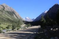
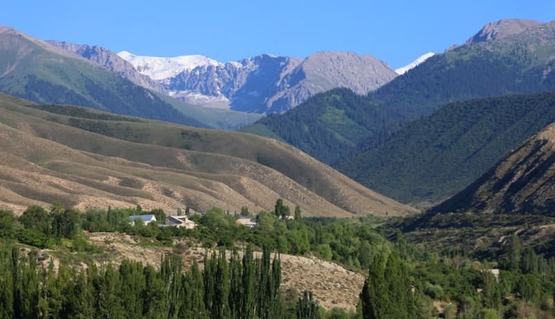
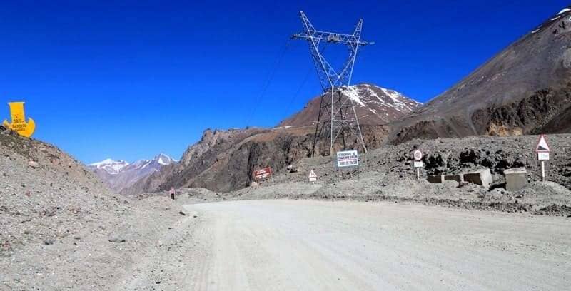
86 kilometers after Karakol, we turn left to the village and Barskoon gorge. The village is located 3.6 kilometers from the southern shore of Lake Issyk-Kul, is located on the right bank of the river of the same name, the eastern part of the village goes to the Chon-Dzhargylchak gorge.
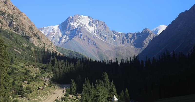
The gorge begins immediately behind the village. It crosses the northern slope of the ridge in the direction from north to south, changing direction to the west in the upper reaches, where the Kerege-Tash River basin is located. It extends along the axial line of the Terskey Ala-Too ridge to a narrow lakeside plain on the southern shore of Lake Issyk-Kul, with a length of about 57 kilometers.
The gorge is used as a pasture and serves as an important route along which the road to the Upper Naryn Valley passes, to the Kumtor mine, through the Karasai outpost, to the village of Uch-Koshkon. The distance from the A-363 Karakol-Balykchy highway to the middle part of the gorge is 21 kilometers.
In the summer, during the tourist season, there is a parking lot, seasonal cafes, barbecue houses, and from here you can take walks to the cascade of waterfalls, which are located in the bed of an unnamed river. In the lower part of the gorge, in the floodplain of the Barskoon River, mainly along its left bank, there are rock paintings.
Images of wild animals are carved on the stones and rocks: goats, deer, horses, camels, hunting scenes, and others. Goat figures predominate. Most of the images are given in the best traditions of the Scythian-Siberian animal style. The drawings were left by the Saka tribes who lived in the Barskoon Valley in the VIIth-IIIrd centuries BC.
The petroglyphs were discovered in 1959 by D. F. Vinnik. The second archaeological attraction of the gorge is the Barskoon settlement, located at an altitude of 1961 meters above sea level, 158 meters from the right bank of the Barskoon River, 5.3 kilometers south of the village of the same name.
The Barskoon settlement consists of central ruins (citadel and shakhristan) and an area surrounded by a long wall. The total area of the settlement is 3970.86 square meters, the perimeter reaches 252.3 meters. The settlement is square in plan, the length of the northern and southern walls is 61 meters, the western and eastern - 63 meters.
It is identified with the city of Barskan, mentioned in written sources of the IXth - XIIIth centuries. The settlement was discovered by D. F. Vinnik in 1959. Soon we will make a stop in a forest clearing, from where we will take a walk to the "Tears of a Barsa" waterfall, the walk to it takes up to 30 - 35 minutes at a leisurely pace.
The waterfall is located at an altitude of 2470 m. a. s. l. The width of the waterfall is about two meters, the height is up to 20 meters, in the lower part the waterfall consists of several cascades. The complex of historical objects and natural monuments in the gorge includes a large stone block located in a forest clearing, not far from the waterfalls, on which there is a bas-relief of the first cosmonaut Yuri Gagarin.
Not far from the stone, a bust of the first cosmonaut is installed on a stele with the inscription "Yu.A. Gagarin, the first cosmonaut in the world." 200 meters above there is a huge stone, enclosed by a small metal fence - "Tagai Biy", according to historical sources, in the vicinity of the gorge in the XVIth century there was the headquarters of Tagai-biy (Muhammad Kyrgyz) - one of the founders of the Kyrgyz statehood. Walk in the vicinity.
Further transfer: forest glade near waterfalls - Sary-Moinok pass (16 km).
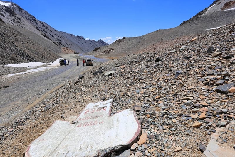
Sary-Moinok pass at an altitude of 3442 m. a. s. l.l, is the first in a series of passes that leads to the valley of the Naryn River. The difference in altitude from the beginning of the ascent to the pass itself is 640 meters. From the northern side, 14 serpentines lead to the pass road. Stop at the pass, walk in the surrounding area.
Transfer: Sary-Moinok Pass - Barskoon Pass (9 km).
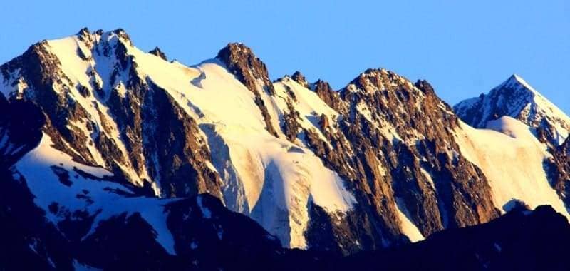
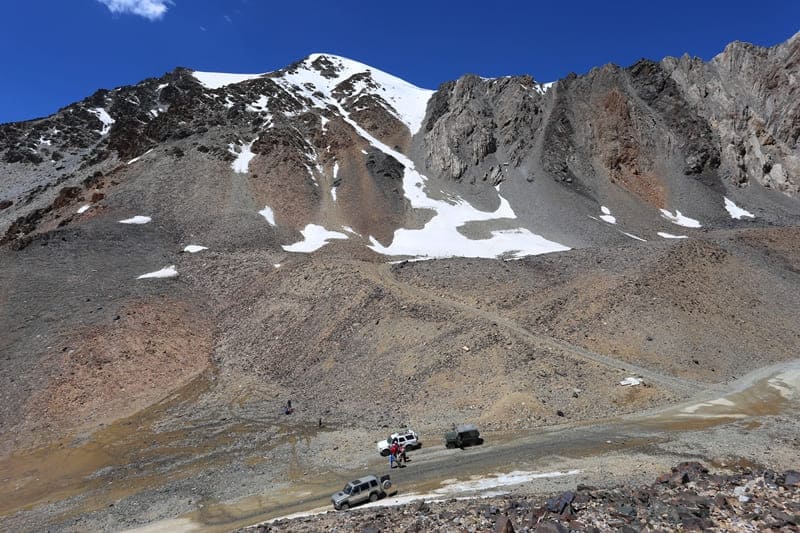
On the northern side of the Barskoon Pass, 3,754 m. a. s. l. the Barskoon River, 62 kilometers long, originates, flowing into the Barskoon Bay on the southern coast of Lake Issyk-Kul. On the southeastern side of the Barskoon Pass, the Arabel-Su River, 41 kilometers long, originates, which is one of the rivers that originate from the Naryn River.
Transfer: Barskoon Pass - Arabel Valley (5 km).
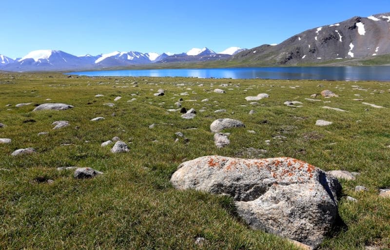
The length of the Arabel Valley, from the southwest to the northeast is 22 kilometers, the width in the western part reaches 4 kilometers, in the central part 8 kilometers, in the eastern part 3.5 kilometers. The area of the high-mountain Arabel Valley is 105.52 square kilometers, the perimeter is 67.54 kilometers.
There are more than 15 large lakes in the valley, including the group of lakes Jashyl-Kel: Western, Southern, Northern and Central Jashyl-Kel. More than 15 small lakes. This is one of the most beautiful high-mountain valleys in the mountains of the Inner Tien-Shan of Kyrgyzstan. Walking in the surrounding area. Lunch on the way.
Transfer: Arabel Valley - Sook Pass (11 km).
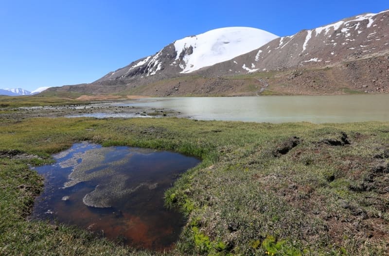
Sook Pass is located between the Arabel-Su and Taragai rivers. Between the Sook Ridge on the northern side is the high-mountain Arabel Valley with numerous lakes, on the southern side are the high-mountain syrts of the Naryn Valley. 6.2 kilometers from the Sook Pass is the high-mountain lake Ekurgen-Kel, 3628.5 m. a. s. l. 11.8 kilometers to the east and a little to the north is the Jetym-Bel Pass, 3993 m. a. s. l.
Transfer: Sook pass – pass and Barskoon settlement – Karakol city (143 km).
Arrival in Karakol, end of the excursion.

Note:
Author program of Alexander Petrov. Copying and introduction from the sanction of author.
Photos by:
Alexander Petrov