


![]()
You are here
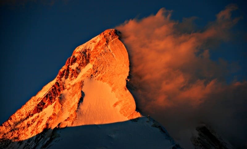
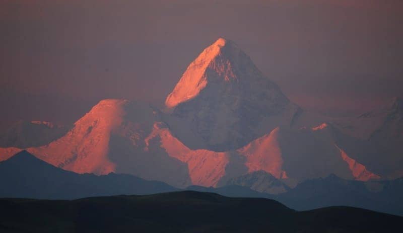
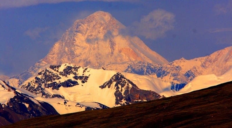
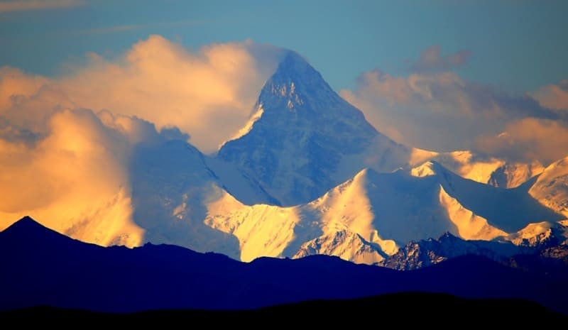
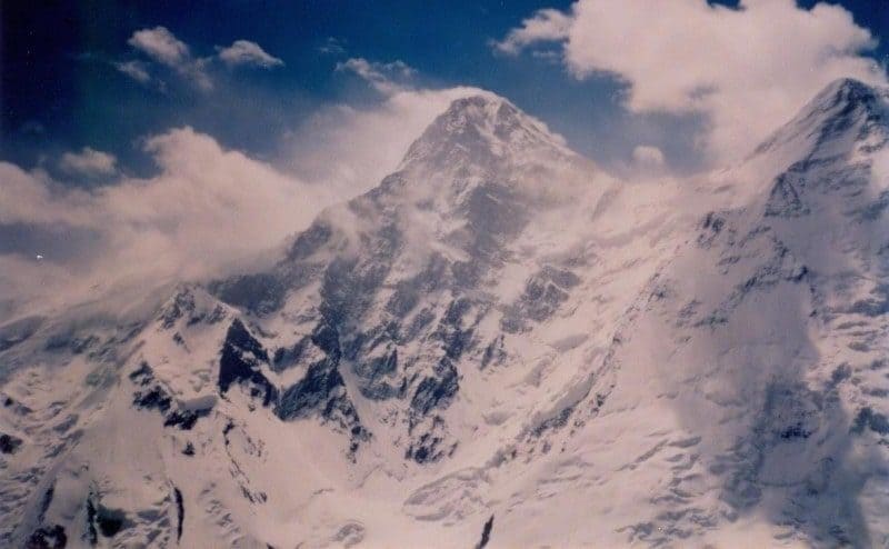
Khan-Tengri Peak.
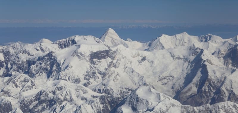
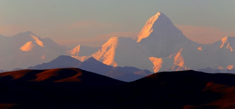
Highest peaks of Central Asia.
“When we reached the top of the mountain pass around one o’clock in the afternoon, we were blinded by an unexpected sight. Directly south of us rose the most majestic mountain range I had ever seen. It all, from top to bottom, consisted of snow giants, which I could count at least thirty to my right and left. This entire ridge, together with the gaps between the mountain peaks, was covered with an uninterrupted veil of eternal snow. In the middle of these giants stood one snow-white pointed pyramid, sharply standing out between them in height, which seemed from the height of the pass to be twice the height of the other peaks... This was the peak of Khan Tengri.”
Russian geographer and traveler P.P. Semenov-Tien-Shansky. 1856.
Peaks of Central Asia.
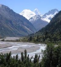
Khan Tengri Peak, 6995 meters above sea level, is a mountain range and peak, located in eastern part of Central Tien-Shan, at junction of borders of Kyrgyzstan, Kazakhstan and China. A pronounced, pyramidal peak, significantly higher than surrounding peaks, is located in eastern part of Tengri-Tag ridge, between Chapaev Peak at 1,6371 meters above sea level in southwest and Saladin (Gutman) Peak at 6,201 meters above sea level in east. Northern slopes of the mountain belong to Kazakhstan and belong to circus of the Northern Inylchek glacier. Eastern slopes are located in Republic of China with northern sources of South Inylchek glacier, western slopes of peak are located in Kyrgyzstan with South Inylchek glacier. It is located in Aksu district in southeast of Issyk-Kul region.
The name is usually translated as “king of spirits,” and this translation is widely known. As E.M. Murzaev rightly pointed out, the name Khan Tengri is of Mongolian origin and means “king of heaven.” At the end of the 80s of the last century, some climbers of Kazakhstan actively involved in commercial mountaineering began to indicate in advertising brochures, photographs, and speeches that the peak of Khan Tengri had a new height, which was determined to be 7010 meters above sea level.
It must be assumed that no one was involved in trigonometric leveling; it should also be noted that this is the prerogative of state bodies of geodesy and cartography. This summit height was proposed to attract climbers to peaks over 7000 meters.
In ancient times, the peak was considered inaccessible to man; this was the opinion that was formed about this graceful pyramid. The regular pyramidal shape of the ridge captivates with its pink-gray marble facade. In the worldview of the ancient Turks, Tengri is the supreme deity, the organizer of the world, together with the goddess Umai and Erlik.
In the Tengrian religion, Tengri (the deity of the upper zone of the world) represents the destinies of people, distributes life span, bestows supreme power in society, and influences it. Thus, the peak of the Tien-Shan Khan Tengri is the residence of the supreme deity.
The state border between Kyrgyzstan and Kazakhstan runs along the top in a western and then northwestern direction to Semenov Peak in the Saryjaz ridge. From the Khan Tengri peak there is a straight line to the Ak-Too (Aktau) peak 6181 meters above sea level located in the central part of the Ak-Too ridge and further to the Eastern Pobeda peak 7079 meters above sea level located in the eastern part of the Kokshaal-Too ridge this line is the border between Kyrgyzstan and the Republic of China.
The first scientific information about it dates back to the middle of the 19th century. Khan Tengri was seen and described during his outstanding journey to the Tien Shan in 1856 - 1857 by the famous Russian geographer and traveler P.P. Semenov-Tien-Shansky.
Khan Tengri Peak is the northernmost and seventh highest in the whole world, and therefore attracts a large number of tourists and climbers from all continents, despite the fact that conquering its peak is very dangerous. The beautiful southwestern, marbled edge delights the peak.
1200 years ago, Khan Tengri Peak was first mentioned in Chinese sources. In 1931, the Ukrainian climber Mikhail Timofeevich Pogrebetsky was the first to conquer its peak. He climbed the south side of the mountain. The route is considered a classic even today.
Khan Tengri Peak is located in a remote region; most tourists travel by helicopter to the foot of the peak in order to set up camps. Climbing the peak is the dream of many climbers around the world. It takes approximately 14 days minimum to reach the top.
Due to Khan Tengri's proximity to the Chinese and Kazakh border, special permission is required for climbing. On the moraine, which was formed at the confluence of the South Inylchek and Zvezdochka glaciers, a mountaineering tent camp is established from the beginning of July to the end of August. Helicopter flights are carried out from an acclimatization camp in the Karkara River gorge on the territory of the Kyrgyz Republic.
Geographic coordinates of Khan Tengri Peak: N42°12'39 E80°10'27
Authority:
Alexander Petrov.
The encyclopedia of Kazakhstan, 1996. and
Photos by:
Alexander Petrov, V. Serbenko