


You are here
Ottuk River tributary of Saryjaz.
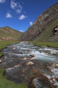
Photo tours in Terskey Ala-Too mountains.
“Acquaintance with almost all the geographical and geological literature on Central Asia allows me to assert that the contribution of Russian scientists to the study of this vast area exceeds the contribution of all other researchers in the aggregate.”
Academician V. A. Obruchev.
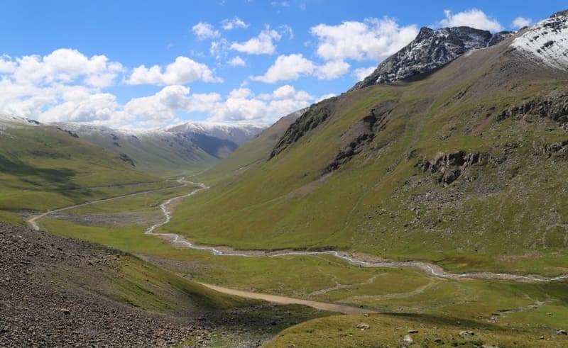
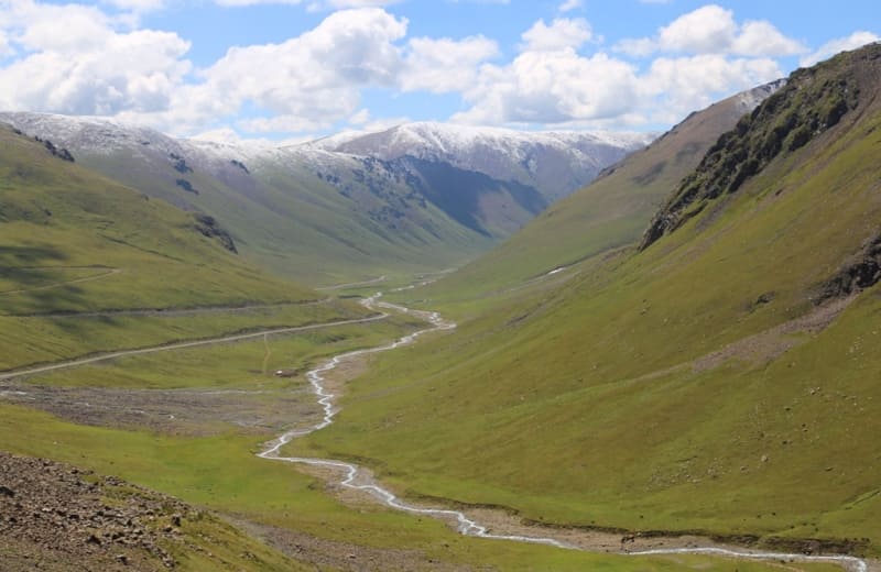
Photos of Terskey Ala-Too mountains.
Ottuk River is located at an altitude: its sources are 4295 and 42249, its mouth is 2733 meters above sea level, it is a right tributary of Saryjaz River, located on southern slope of Terskey Ala-Too ridge in Ak-Su district of Issyk-Kul region.
After 78 kilometers from the beginning of the sources or after 11.5 kilometers before the Kuylyu tributary flows into the Saryjaz River on the right, a large tributary Ottuk with a length of 24.3 kilometers flows into the right. In addition to the described tributaries, the river has 8 more small, nameless right tributaries, and on the left the river receives 4 small tributaries. The mouth of the river is located at an altitude of 2733 meters above sea level.
Geographic coordinates of Ottuk River: N42°19'00 E79°03'37
Left tributaries of Ottuk River.
Chon-Ashu River.
After 4.3 kilometers from the beginning of its sources, the 3.8-kilometer-long tributary Chon-Ashu flows into the Ottuk River on the left. The sources of the river are located on the southern slope of the Chon-Ashu pass at an altitude of 3822 meters above sea level on the southern slope of the Terskey Ala-Too ridge.
Geographic coordinates of Chon-Ashu River: N42°22'07 E79°03'17
River Kichine-Burkut.
After 11.2 kilometers from the beginning of its sources, the Kichine-Burkut tributary, 11.4 kilometers long, flows into the Ottuk River from the left. The river is located on the southern slope of the Terskey Ala-Too ridge. In the upper reaches of the river there is a moraine, flowing, fresh lake Kichine-Burkut located at an altitude of 3677 meters above sea level, which is the source of the river of the same name in the Ottuk basin, located on the southern slope of the Terskey Ala-Too ridge in the Ak-Suu district in the southeast of Issyk -Kul region.
The lake of dammed origin is located in the upper part of the gorge of the same name in the interfluve of the Chon-Burkut and Chon-Ashu. The area of the lake is 164,788.29 square meters, the length of the coastline reaches 1,789 meters. The length of the lake is 675 meters, the greatest width in the northern part of the lake is 395 meters.
The southern part of the lake is swampy, the Kichine-Burkut River flows through the lake, and the sources of the river are located in the southern part of the lake. The lake is fed by two tributaries, which flow into the northern part of the lake. The tributaries originate from a small glacier located 1 kilometer north of the lake.
The area of the glacier is 187,445.29 square kilometers, the perimeter of the glacier reaches 1,698.34 meters. The length of the glacier is 430 meters. The upper boundary of the glacier is located at an altitude of 3993 meters above sea level.
Geographic coordinates of Lake Kichine-Burkut: N42°21'43 E79°07'06
Geographic coordinates of Kichine-Burkut River: N42°19'53 E79°06'18
Oldzhbay River.
After 22.5 kilometers from the beginning of its sources, a 5-kilometer-long Oljabay tributary flows into the Ottuk River on the right. The sources of the river are located at an altitude of 3925 meters above sea level on the southern slope of the Terskey Ala-Too ridge.
Geographic coordinates of Oljabay River: N42°16'22 E79°05'56
Right tributaries of Ottuk River.
Mamun-Tor River.
After 13.1 kilometers from the beginning of its sources, the Mamun-Tor tributary, 6.8 kilometers long, flows into the Ottuk River on the right. At an altitude of 3425 meters above sea level, the river forms its main channel. The right, western and northern tributaries originate at an altitude of 4295 meters above sea level.
Geographic coordinates of Mamun Tor River: N42°18'16 E79°02'20
Kashkasu River.
After 14.9 kilometers from the beginning of its sources, the Kashkasu tributary, 10 kilometers long, flows into the Ottuk River on the right. The sources of the river are located at an altitude of 4224 meters above sea level on the southern slope of the Terskey Ala-Too ridge.
Geographic coordinates of Kashkasu River: N42°17'38 E78°59'45
Bekbulak-Tor River.
After 16.9 kilometers from the beginning of its sources, the Bekbulak-Tor tributary, 8.8 kilometers long, flows into the Ottuk River on the right. This is the second longest tributary after the Ottuk River. The river is located on the southern slope of the Terskey Ala-Too ridge.
The river takes its sources from the small glacier Bekbulak-Tor, the area of which is 0.2 square kilometers, the perimeter of the glacier reaches 2.02 kilometers. The upper boundary of the glacier is located at an altitude of 4196 meters above sea level. On the northern slope, at the source there are 2 small glaciers from where the river receives tributaries.
Geographic coordinates of Bekbulak-Tor River: N42°16'29 E78°59'05
Sarygulat River.
After 82 kilometers from the beginning of its sources, the Sarygulat tributary, 4.3 kilometers long, flows into the Saryjaz River from the right. The river is located between the Ottuk and Kuilyu rivers, located on the southern slope of the Terskey Ala-Too ridge. The sources of the river are located at an altitude of 3563 meters above sea level.
Geographic coordinates of Sarygulat River: N42°13'14 E79°06'12


Authority and photos by:
Alexander Petrov.