You are here
Nature of Baikonur.

Space tourism in Kazakhstan.
“Like a poplar, like a fragrant torch, it will rise,
Like the July linden clouds the mind,
Whispers starflowers in the night like lilacs.
And the apple tree will scatter its blossom throughout the garden,
And cherry fawns on a child’s gaze,
The bird cherry tree offers a fragrant shadow.
Will spread out the carving of the emerald maple,
And a long song of green ringing
t enchants drowsy laziness."
Balmont K.D. “Slavic tree”.
Visit to Baikonur Cosmodrome.
Town of Baikonur is located in a semi-desert zone with geographical coordinates of 45 degrees 57 minutes north latitude and 63 degrees 18 minutes east longitude on the territory of the Republic of Kazakhstan. rom the south, its territory was limited by the Orenburg - Tashkent railway line, and from the north by the Karaganda - Akmolinsk - Kartaly railway. In the west, the territory adjoins the Big Barsuki sands and the Turgai and Ishim rivers.
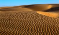
The eastern part is limited by the Karaganda-Dzhezkazgan railway line and the Sary-Su River. The southern part of the Baikonur Cosmodrome is located in the Syrdarya Lowland, which is a flat, slightly hilly sandy plain with a gradual increase to the northeast, on which small hills and lowlands are occasionally found.
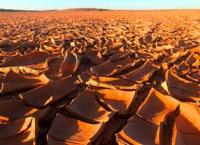
Individual hills and ridges rise above the plain by 6 - 10 meters and have gentle slopes. A traveler can sometimes encounter higher dome-shaped peaks and table plateaus, bordered by cliffs, and in the lowlands he can see plump salt marshes, sors (salt marshes with efflorescences of white salts on the surface, having a marshy bottom), takyrs (flat clayey spaces, which in the spring and during rains they usually turn into small lakes, and when they dry out, their clayey surface cracks and becomes like parquet) and rarely, if you’re lucky, small salt lakes.
In the central and northern part of the positional area, the surface is small hills, that is, old, heavily destroyed mountains that have turned into rows of isolated hills and individual hills with gentle slopes and soft rounded outlines.
Only individual peaks of the hills reach a height of 80 - 100 meters. In the southwestern part of the small hills there is a relatively high Ulutau mountain range. It is composed of granite and other dense rocks. There are also individual mountains that rise above low areas up to 400 meters, and their absolute height reaches 700 meters.
The peak of Mount Ulutau dominates the surrounding area at 1134 meters above sea level. The northern part of the small hills is flattened, there are almost no separate hills, and hills and ridges with gentle slopes predominate.
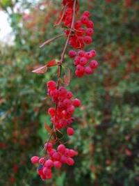
There are no natural forests throughout the entire territory of the cosmodrome. In some places you can hide from the sun in rare groves of saxaul and tamarisk, and if you walk along the beds of drying up rivers, you will come across thickets of thorny bushes up to two meters high.
The northern part of the dry steppe zone has a grass cover of good density, mainly of steppe grasses - narrow-leaved and feathery feather grass, kipchak, keleria, and dicotyledonous grasses are found on the chernozem soil (black earth).
The middle and southern part - the zone of semi-desert and temperate desert - is covered with sparse vegetation, consisting of a wide variety of wormwood, saltwort and camel thorn. There is no continuous vegetation cover here; the plants are located at a considerable distance from each other. In the gaps the bare soil is visible.
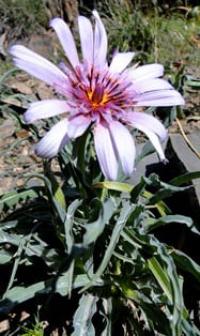
In spring, the steppe is covered with a carpet of quickly fading plants - ephemerals. By the end of spring, all of the indicated vegetation burns out, and only dry-loving thorns, bitter wormwood and solyanka remain. Tugai thickets of azhrek grass, reeds and thorny bushes are widespread along the Syrdarya lowland.
The entire area is open and clearly visible from above. If you climb a separate hill, ridge or top of a hill, then in good clear weather the surrounding area is visible up to 15 - 20 kilometers, but on a cloudy day visibility decreases to 3 - 5 kilometers.
During sandstorms and very rare fogs, the traveler runs the risk of losing orientation, as visibility is sharply reduced to several tens of meters, and sometimes even less. The soil cover and soils of the landfill area are extremely diverse. In the northern part of the test site there are chernozems and dark chestnut soils suitable for arable land.
But the layer of chernozem is not large - only 0.4 - 0.5 meters, under which lie loamy and saline soils. In the semi-desert and desert zones, light chestnut saline land soils predominate - saline sierozems. At a depth below 0.5 meters, a large amount of carbonates and gypsum appears,
In the conditions of small hills, crushed stone soils are often found, the surface of which is strewn with crushed stone soldered into the surface of the earth. In the Syrdarya lowland, saline meadows and plump solonchaks with rare clayey areas - takyrs - are common.
Plump salt marshes lie in depressions, usually flooded with water. In summer, when the sun strongly warms the soil, salts rise to the surface of the soil, forming a loose and puffy layer; under it there is a viscous and wet layer with an abundance of gypsum salts.
Sandy areas consist of fixed, hummocky sands with extremely thin soil cover. Sand vegetation is easily destroyed. In the summer, the movement of all types of mechanical transport without roads, perhaps almost everywhere, except for the plump salt marshes and rubbish, because they are impassable at any time of the year.
The sands of Big and Small Barsuki, Moiynkum and weakly secured areas of the Aral Karakum are also impassable. In the spring, dry river beds fill with water and become insurmountable for transport. n flat areas you can also find gullies up to one meter deep.
In terms of living conditions for animals, semi-desert landscapes are close to desert ones - open territory, lack of water, sharp seasonal and interannual fluctuations in food. The mass of soil invertebrates does not exceed 20 - 30 kg/ha.
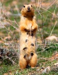
The species composition of vertebrates is not rich. Green eaters predominate, rodents are especially characteristic. The first place in terms of mass is occupied by gophers. There are four known species of jerboas, gerbils, hamsters, etc., among insectivores - the long-eared hedgehog, among predators - the steppe ferret, corsac, wolf, fox, badger, ermine, weasel.
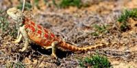
Of the ungulates, the saiga is found in the southern regions. The most common representative of birds is the little lark, and insects are darkling beetles. About 90 species of mammals are known in the steppe zone, a third of which are endemic to the steppe.
The most numerous group is rodents (gophers, voles, pikas, ground hares, jerboas, gray hamsters, mole voles, marmots). In the east of the steppe zone, saiga and gazelle are still preserved. The endemic predators are the steppe polecat and corsac fox.
There are also widespread species such as badger, ermine, weasel, and fox. Typical birds are the bustard, little bustard, gray partridge, steppe eagle, buzzard, and kestrel. The snow cover in the middle and southern parts of the site is very insignificant, but due to constant and strong winds it can accumulate in low areas, forming significant snowdrifts.
Deep snow usually falls in the northern part, where all depressions and roads are covered with a thick layer of snow. The spring period here is longer, and the entire area dries out only by the end of May. If you drive a car or tractor off the roads, then the trail left by the vehicle is not overgrown with vegetation for a long time.
Clouds of fine and caustic dust remain in the air for a long time. The hydrographic network of the cosmodrome is very poor and its water supply is insufficient. In the central and northern parts there are many rivers that live only in spring during the snowmelt period. In summer they dry up and turn into dry riverbeds and small lakes, the water in which becomes brackish and musty by the end of summer.
Only the Ishim and Nura rivers do not dry up. In all the lakes found, the water is usually bitterly salty. Groundwater lies at great depths and can only be used from artesian wells. But the water in them is most often brackish. Some wells are low-power, the water in which contains a lot of salts.
The traveler may be lucky: he will be lucky enough to come across a well in which there is a large supply of good fresh water, where the aquifer lies shallow from the surface. In the southern part of Baikonur flows one of the richest rivers in Central Asia - the Syr Darya, which has no tributaries in its lower reaches.
This great Central Asian river, and the fresh lakes formed by it, could satisfy any need, but the water in it is sandy-earthy in color and contains a lot of silty particles, and therefore requires long-term sedimentation and filtration.
The river flows through a loamy-sandy plain, covered with sandy mounds rising 10 - 20 meters above it. The river valley has no clear boundary. In high-water years, during floods, as well as in winter when water jams, rivers in various places overflow their banks, forming significant spills.
The water is turbid during high water and slightly turbid in summer. Total water hardness is 15 -17 °, constant hardness is 10.6 °. In winter the river freezes. The beginning of the autumn ice drift is November 13 (early) - December 21 (late).
The beginning of freeze-up is November 19 (early) or January 12 (late). Spring ice drift begins on March 5 (early) or April 9 (late). The river is cleared of ice by March 6 (early) or April 12 (late). The duration of freeze-up is up to 4 months.
The ice cover is stable, with the greatest ice thickness reaching one meter. The long-term average maximum ice thickness is 110 cm, and the minimum thickness is 40 cm. The prevailing width of the river until the mid-70s was 200 meters.
Since then, the width of the river has decreased significantly and in the area of the city of Baikonur it does not exceed 100 meters. The prevailing depth of the river is 3 meters, the greatest depth is 8 meters. The prevailing speed of the river flow is 0.8 meters per second.
The absolute minimum air temperature is 36°C, and the absolute maximum is + 44°C. The long-term average date of the first frost is October 9, the last frost is April 15. The dominant wind direction is east and west. The average long-term number of days with fog is 18, with thunderstorms - 5, with snowstorms - 6, with snow cover - 110.
The average long-term precipitation is 98 mm, the highest is 181 mm, the least is 68 mm.
Authority:
© 2003 Kosmodrom Baikonur baikonur @ nm. ru
Photos by
Alexander Petrov.


