


![]()
You are here
Excursion trip to Uygen-Tas stone mound.
Nature and travels in Kazakhstan.
“His Majesty was very smart, educated and eloquent, but he also had all the prejudices inherent in crowned heads; Moreover, he was a king-traveler, that is, he had completely false ideas about everything he saw abroad, since such noble travelers are shown everything from the best side and everything is arranged and adjusted so as to make the best impression ."
Ekaterina Dashkova. “Memoirs of Princess E.R. Dashkova, written by herself. Translation from English G.E. Blagosvetlova. Leipzig. E.L. Kasprowicz, 1876 (Weimar:).Excursion trip to Uygen-Tas stone mound.
Saki burial mounds in Southern Kazakhstan.
Short description of trip route to Tentek River valley:
Almaty - town of Konave - town of Taldykorgan - village of Kyzyl-Agash – Zhansugurovo settlement - village of Koilyk - village of Kolbay - village of Kabanbay Batyr - village of Akzhar - village of Lepsi (Lepsinsk) - Almaty.
Distance of route: 1168 km.
Season: from April to October 10.
Duration of trip: 3 days, 2 nights.
Distance of active part of excursion: 1 km.
Best time for trip: June - August.
Detailed program of study tour in Semirechye and in mountains of Dzhungarsky Alatau:
Day 1. Almaty – Lepsi village (547 km).
Transfer: Almaty - Konaev town - Taldykorgan town - Zhansugurovo village - Koilyk village - Kolbay village - Kabanbay Batyr village - Akzhar village - Lepsi village (Lepsinsk) (547 km).
Departure from Almaty at 7.00. The path from Almaty leads to the northeast, through the city of Konaev (formerly Kapshagai), which is the administrative center of the Almaty region. The country's largest gambling zone with casinos and hotels is located in the roadside, western and northwestern parts of the town.
The Kapshagai reservoir, which stretches from west to east for almost 100 kilometers with beaches, boarding houses, hotels and holiday homes, is adjacent to the town. Soon, along the bypass road, we pass the city of Taldykorgan, which is the administrative city of the Zhetysu region, and then our path lies along the northern slopes of the Dzhungar Alatau. Arrival in the village of Lepsi, accommodation in a guest house, dinner.
Day 2. Lepsi village – Uygentas mound (74 km).
Transfer: Lepsi village – Koktobe pass (9 km).
We leave the village of Lepsy to the north, cross the bridge over the Lepsy River and immediately turn east, passing the rural hippodrome, which remains on our left side. We drive 7 kilometers from the bridge over the Lepsy River and gradually begin to climb the mountains.
Our path lies to the Koktobe pass, 1797.5 meters above sea level, which divides the Zhanzhurek mountains into western and eastern parts. The Zhanzhurek Mountains are the northern spur of the Dzungarian Alatau ridge, which stretch 13 kilometers in the latitudinal direction.
The eastern border of the mountains is the Tentek River, in the south the mountains border the right bank of the Lepsy River, in the west the mountains gently descend into the valley of the Lepsy River. The highest point of the mountains is the peak of Koktobe, 1814.4 meters above sea level, which rises 500 meters in the southeast of the Koktobe pass.
At the pass there is a radio broadcaster that provides communications and television to the villages of Lepsinsk and Zhanzhurek. Stop at the pass. From the pass a picturesque panorama of the northern slope of the Dzungarian Alatau ridge and the surrounding area opens up. A short walk in the environs of the pass.
Transfer: Koktobe pass – Tentek river – Uygentas mound (28 km).
Our path lies to the east, we move among the hills, cross the sources of the Krutaya River, which is the left tributary of the Lepsy, and gradually begin our descent into the valley of the Tentek River. Before descending to the Tentek River, Mount Zhunzhuru rises in the south, 1733 meters above sea level.
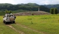
The road takes us to the left bank of the Tentek, from here we turn at an acute angle and head south, passing a ford across the small river Rybny Klyuch, which flows into the Tentek on the left. After 1.5 kilometers we cross the bridge over the Tentek River to the right side and after 600 meters we reach the Uygentas mound.
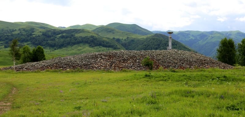
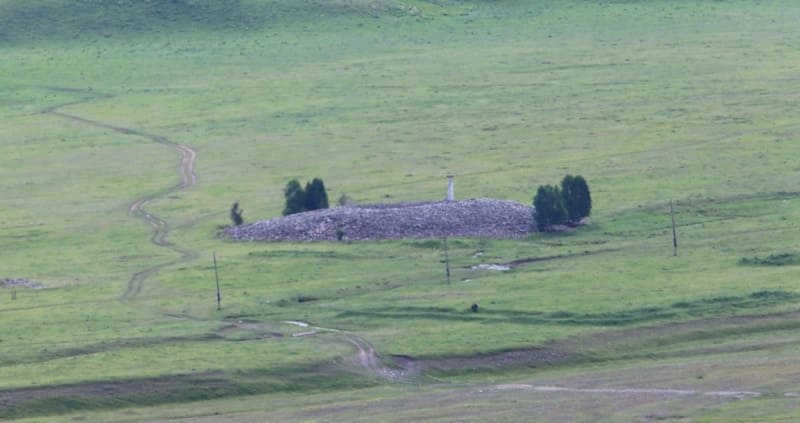
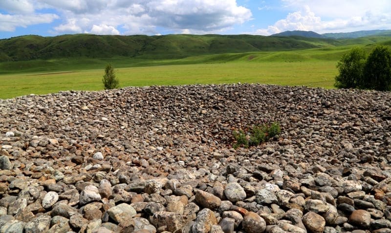
The mound of oval stones Uygen-Tas is located at an altitude of 1374 meters above sea level, located between the Tentek and Ipili rivers. Here, 250 meters south of the Uygen-Tas mound, there are L-shaped ruins with slumped earthen walls, which consisted of five rooms with separate entrances measuring 20 x 10 meters. 140 meters northwest of the mound there is another completely identical L-shaped structure.
Dimensions of the Uygen-Tas mound: height 6 meters, length of the mound from south to north 65 meters, width from west to east is 74 meters, area of the mound is 3778.78 square meters, perimeter of the mound reaches 221 meters. Apparently, the mound is a funerary burial.
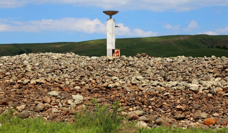
On the right bank terrace of the Tentek River, in the vicinity of the mound, there are about ten small burials. In the southern part of the mound there is a reinforced concrete structure without inscriptions. Judging by the sunken, collapsed central part, the mound was plundered in ancient times.
No modern excavations or surveys have been carried out by archaeologists. The well-known legend about Tamerlane, who passed here with his army, is associated with the mound. The terrible ruler ordered each of his warriors to put a stone in a pile. Returning, each warrior also took one boulder from the pile.
The remaining and counted stones gave the number of those killed in the battles. A very similar San-Tash mound, somewhat smaller in size, made of the same oval stones, is located in the Tyup district of the Issyk-Kul region in the southeastern part of the Kungei Alatau ridge.
The Kazakh explorer and traveler Chokan Valikhanov visited the San-Tash mound in May 1856. Walk in the vicinity of the mound. Lunch on the banks of the Tentek River.
Return to village of Lepsi (37 km). Arrival in the village of Lepsi, end of the trip.
Day 3. Lepsi – Almaty (547 km).
Breakfast. Transfer: Lepsi - Akzhar village - Kabanbai village - Koilyk village - Sarkand village - Zhansugurov village - Kyzyl-Agash village - Taldykorgan town (284 km). Lunch at a local cafe.
Further transfer: Taldykorgan - town of Konaev - Almaty (263 km). Arrival in Almaty, end of the tour.
Details of program “Excursion trip to Uygen-Tas stone mound:
1. In the village of Lepsi, accommodation is in a private, rural house, which does not have a bathroom - toilet and shower. The village toilet is located in the courtyard of the house. If desired, you can prepare a Russian bath with hot and cold water.
2. There are no cafes or restaurants in the village. Meals (lunch and dinner on the first day, and breakfast on the second day) will be in a private home, prepared by the family. During your stay, you can get to know better the family customs and everyday traditions of a modern Kazakh family; it can also be a family of a different nationality.
Note:
Author program by Alexander Petrov. Copying and use of material - with permission of author.
Photos by:
Alexander Petrov.