


Вы здесь
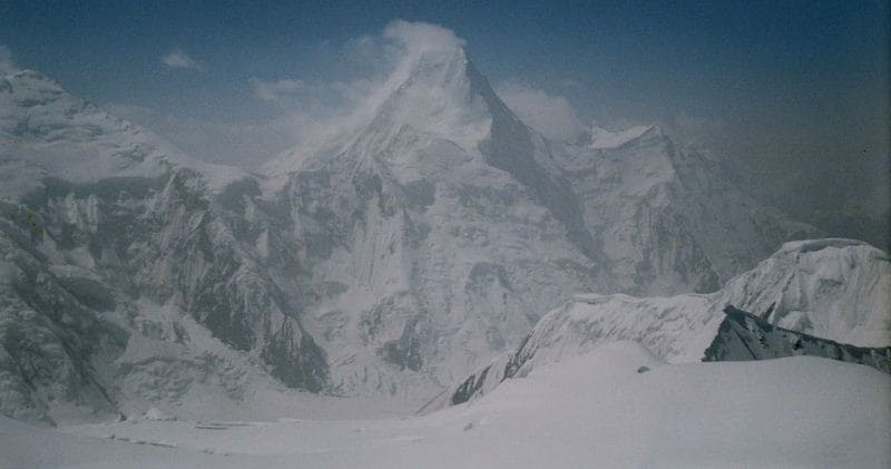
Peak Marble Wall.


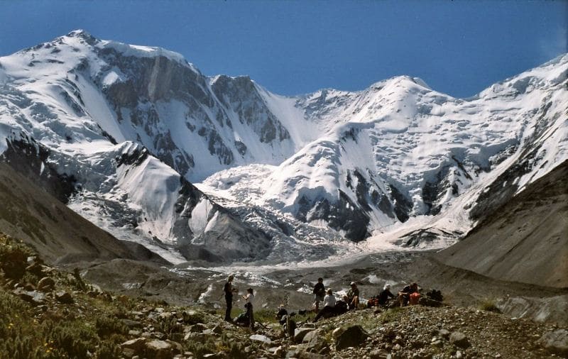
Climb to Central Tien-Shan Peaks.
“What are men to rocks and mountains?”
Jane Austen. «Pride and Prejudice».
Tours to Bayankol gorge.
Peak Marble Wall 6140 meters above sea level is located in the northern part, the main ridge of the Meridional ridge, in the Narynkol district of the Almaty region. In the middle part of the two western ridges, which adjoin the Meridional ridge - Tengri Tau in the south and Saryjaz in the north, there is the peak of the Marble Wall.
The top of the Marble Wall is located 1.7 kilometers north of the peak of 100 years of the Russian Geographical Society with a height of 6276 meters above sea level along the line of the Meridional Ridge. 3.3 kilometers to the north and a little to the west is the top of the Plateau, 5850 meters above sea level.
The state border between the Republic of Kazakhstan and the Republic of China passes through the peak from north to south. On the western side of the Marble Wall peak, where the vertical, marble wall breaks down into the abyss, the headwaters of one of the longest glaciers of the Central Tien Shan - North Inylchek - begin.
The length of the Northern Inylchek glacier along the territory of Kazakhstan from the wall of the Marble Wall to the border with Kyrgyzstan is 11 kilometers. The total length of the North Inylchek glacier is 38 kilometers, including the length of the seasonal Merzbacher lake.
The snowy peak from the west is decorated with a kilometer-long wall of black and yellow marble, with a huge ice cap hanging from above.
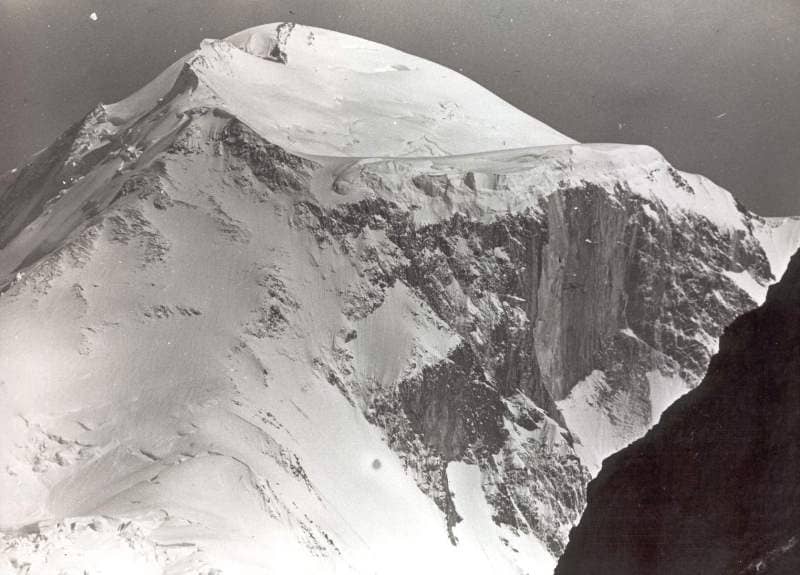
From history of conquest of Marble Wall peak.
The name "Marble Wall" was given by G. Mertsbacher to the main peak, which closes the Bayankol Gorge. The northwestern part of this ice-bound summit is an almost vertical wall, bare from snow and ice, about two thousand meters high, consisting of white and striped marble. G. Merzbacher's attempt in 1902 to climb the peak of the Marble Wall was unsuccessful.
Merzbacher believed that the reason for his failure was extremely unfavorable weather conditions, the specific qualities of snow in the high-mountainous Tien Shan, especially dangerous in terms of the formation of avalanches, and the lack of well-trained and trained porters.
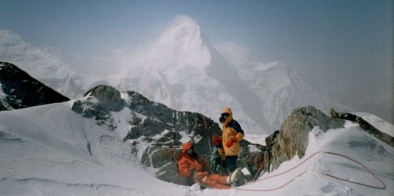
In 1935, Soviet climbers led by E.S. Levin made an attempt to conquer the top of the Marble Wall. The group reached an altitude of 5000 - 5300 meters above sea level, but the avalanche, which partially covered the tents on the slope, forced the climbers to retreat.
11 years later, on August 28, 1946, the expedition of the All-Union Sports Committee led by A.A. Letaveta conquered the Marble Wall (6146) through the Pogranichnik peak (6146), for which the participants were awarded diplomas, and the peak of Nikolai Mikhailovich (6400) was renamed the 100th Anniversary of VGO peak in honor of the centenary of the founding of the Russian Geographical Society (1845).
In 1953, Kazakh climbers of V. Shipilov's group again stormed the peaks of this area. Through the icefall, we reached the ridge above the Pogranichnik peak at a height of 5100 meters above sea level, ascended to a plateau at a height of 6146 meters above sea level and then ascended to a peak at an altitude of 6400 meters above sea level, declaring it the actual Marble Wall (6350).
P.S. The new and more accurate height of the Marble Wall peak was determined by P.K. Rykalov in July-August 2009, during a hike of the 6th category of difficulty in the eastern part of the Central Tien Shan. The height of the Marble Wall peak was 6140 meters above sea level.
Geographic coordinates of the Marble Wall peak: N42 ° 15'17.10 "E80 ° 17'04.07"
Authority:
Alexander Petrov.
Photos by
Sergey Mikhalkov, Ilya Naimushin.