


You are here
Tour valley Baysary - Airakty.
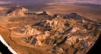
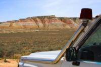
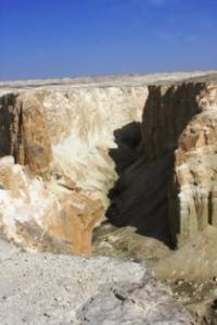
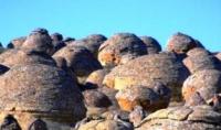
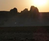
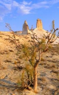
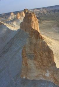
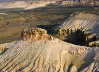
Photo travel across Mangyshlak.
"The blind person can go round the whole world and to notice nothing"
Thomas Karleyl.
Short description of route of tour to natural sights of Mangyshlak:
Aktau - Karagiye hollow - town Zhanaozen - settlement Senek – mount Bokty – valley Baysary – Boszhira valley - mosque Beket ata – mosque Shopan ata – saline march Tuzbair – valley Kokala - settlement Shetpe – Yurt Cam “Etnoaul” - mount Sherkala - valley Ayrakty-Shomanay - valley Torysh - town Aktau.
Distance of the route: 783 km.
Season: April - September.
Best time for tour: April, May, June, September.
Duration of tour: 3 days, 2 nights.
Detailed program of a tour day by day to Mangyshlak peninsula:
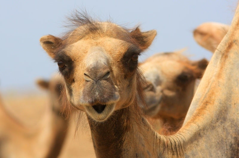
Photographs of Mangyshlak.
Day 1. Aktau - Karagiye hollow - town Zhanaozen - settlement Senek - settlement Akkuduk - hollow Karynzharyk - (267 km).
Transfer: Aktau - Karagiye hollow (30 km). After Aktau, throughout 31 kilometers the asphalt road crosses the deepest hollow in Kazakhstan - Karagiye which is 132 meters lower than the level of the Baltic Sea. The lowest place where there passes the highway - 119 meters. A stop for photography, walk in vicinities.
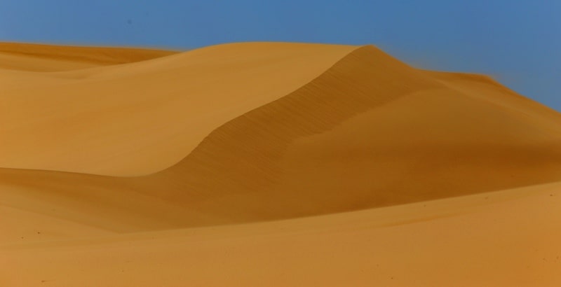
Transfer: Karagiye hollow - town Zhanaozen - settlement Senek - Tuyesu sands (170 km). After the settlement of Kyzylsu a stop at a monument to stone spherical concretion, photography. Further transfer to the settlement of Senek. Behind the settlement of Senek a stop at Tuyesu sands, walk in vicinities, photography.
Further transfer: Tuyesu sands - Besokty well - the natural boundary Azhirektyoy - Bokty mountain (37 km). After the settlement of Senek we will move along a ledge (eminence) of Kulandy which is from West side. In 19 kilometers from the settlement on Senek, on the East, to us Besokty well on the way will meet cold, clear water, here it is possible to fill up water-supplies.
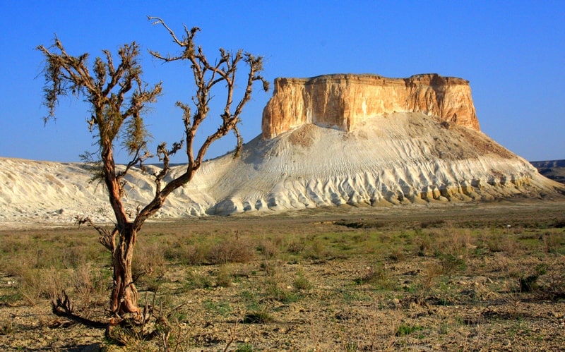
Through 18 kilometers, moving the northeast, we arrive to Bokty mount. Mount Bokty is between Baysary natural boundary in the south and the highway Zhanaozen – Bektau ata mosque in the north. Height of the mountain of Bokty of 165,8 meters above sea level. Mount Bokty a unique sight of the nature on the Western chink of the Ustyurt plateau. Walks in environs. Lunch on the way.
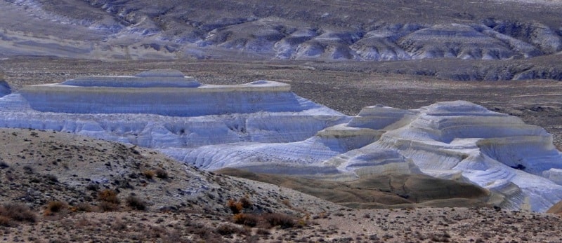
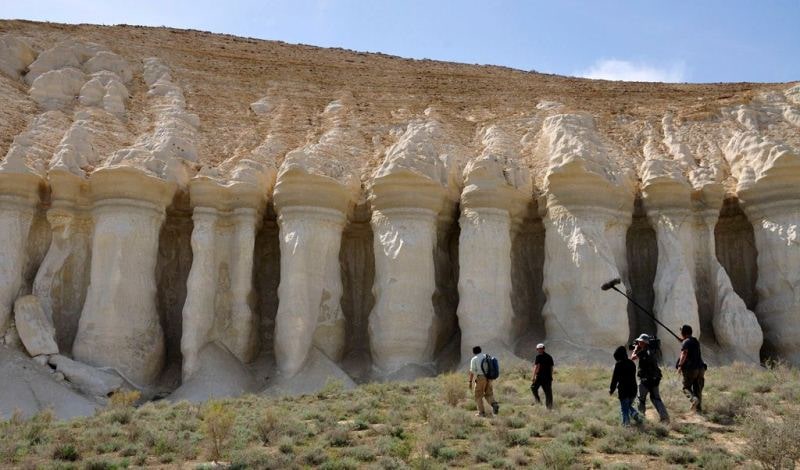
Transfer: Bokty mount - Baysary natural boundary (12 km). Visit of cretaceous colonnades Baysary on the edge a cliff, walks in environs.
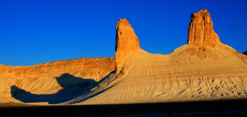
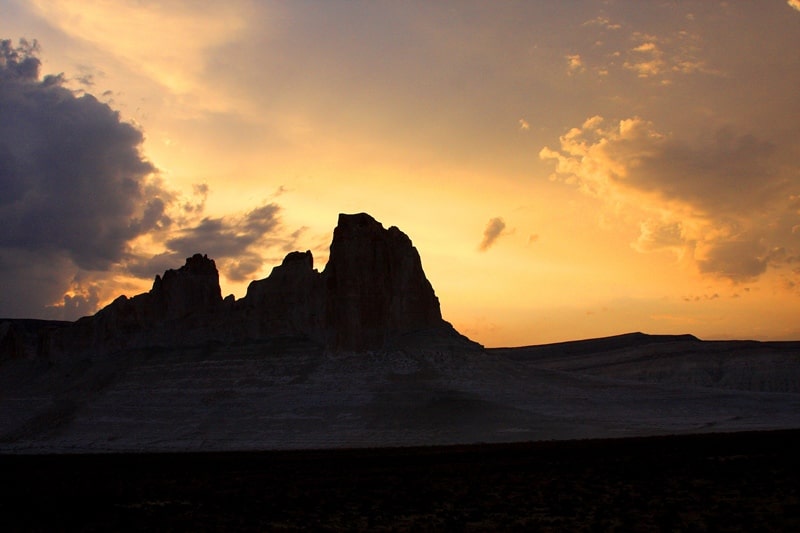
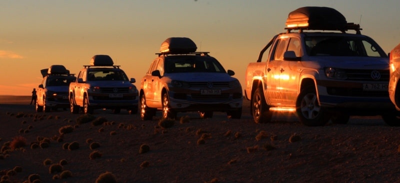
Further transfer: Baysary natural boundary - Boszhira natural boundary (18 km). Boszhira natural boundary is located on the western slopes of the Western chink of Ustyurt, this most sublime place with unique mountains stack. From North side Boszhira natural boundary is limited to the highway Zhanaozen - the mosque Beket ata, from South side the natural boundary is limited to saline march Karashek. Walk in the neighborhood of Boszhira natural boundary. Dinner and overnight in the tents.
Day 2. Boszhira natural boundary - the mosque Beket ata (216 km).
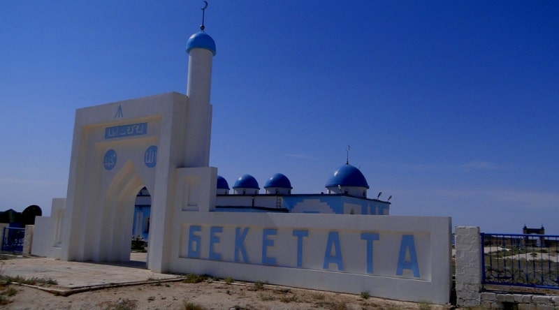
Breakfast. Transfer: Boszhira natural boundary - Zhusaly raising - the natural boundary Oglan ata - the mosque Beket ata a (44 km). Arrival in the natural boundary Oglan ata 305,2 meters above sea level, visit of the mausoleum Oglan ata. Descent on the steps which are laid out from shelly plates to the underground mosque Beket ata. Distance from descent to the underground mosque 1 kilometer 300 meters (25 - 30 minutes). Difference on height from edge of cliff of Ustyurt to the mosque Beket ata makes about 200 meters.
Visit of the mosque Beket ata, it is possible to listen to a prayer of the local mullah here. Walk to an ancient necropolis which is below the mosque (300 meters). According to legends, Beket ata lived in cretaceous rooms in a cave there was a kitchen and two rooms which are cut down in rocks of a shell rock.
Return to the top mosque Beket ata (35 minutes - 1 hour). Visit of the underground mosque Beket ata meetings with the Ustyurt mouflons which chose to themselves the natural boundary Oglan ata can be fine decoration of ours, here they live and breed under protection of the Saint Beket ata. Visit of the top mosque Beket ata, tea drinking, lunch.
Transfer: the mosque Beket ata - the natural boundary Sutbulak - Golbonshe hillock - Kyzylsu natural boundary - the mosque Shopan ata (69 km). Arrival to the mosque Shopan ata. Walk to the underground mosque, by saint tomb and a necropolis Shopan ata. Photography of a necropolis and underground mosque.
Transfer: the mosque Shopan ata – saint tomb Kostam – saline march Tuzbair (73 km). Through 13 kilometers after the mosque Shopan ata we will reach sands Tyshkankum which settle down from East side from the road, on the left side, in the West, from the road sands Bostankum lie.
There where sands Bostankum border on sands Sauskan we is turned on the North and we move along the “Central Asia-Center” gas pipeline. Arrival on saline march Tuzbair, here a northern part of litter is on the western border of the Western chink of Ustyurt. A lunch in a shadow of rocks.
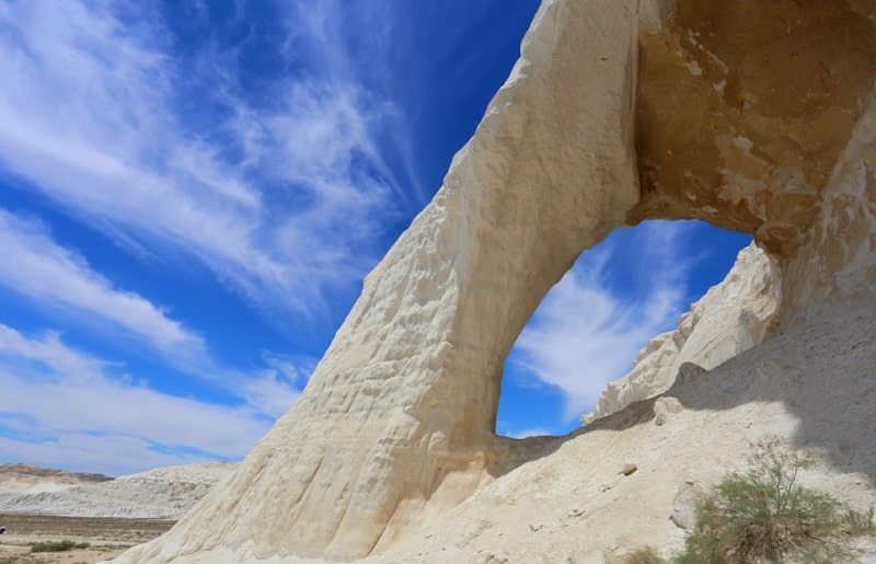
After a lunch our travel by a northeast part of saline march Tuzbair before the 10th railway junction on the automobile route Aktau - Beyneu (56 km) begins. We move along the Western cliff of Ustyurt in the South and the West there is saline march Tuzbair, we visit the most significant, picturesque and interesting sights Tuzbair. Visit of the well-known Arch of Tuzbair, photography of environs.
Transfer: The 10th railway junction - the settlement of Zharmysh - Kokala the natural boundary of multi-colored clays (46 km). Walk in environs.
Transfer: Kokala the natural boundary - the settlement of Shetpe - the yurts camp “Etnoaul” (34 km). Arrival in the yurts camp, accommodation, dinner and overnight.
Day 3. Yurt Camp Etnoaul - town Aktau (204 km).
Breakfast. Transfer: Yurt Camp "Etnoaul" - ancient settlement Kyzyl kala (8 km). Visit of the ancient ancient settlement Kyzyl kala and valley Akmysh, walk in vicinities.
Transfer: ancient settlement Kyzyl kala - Sherkala mountain (2 km). Walk in the vicinities of Sherkala mountain. Mount Sherkal 308 meters high above sea level in translation from Kazakh – Mount Lion, is near the valley Akmysh. Mount Sherkala it is extended from the North on the South more than on 1 kilometer.
The southern part of the mountain the highest and here is the absolute height of the mountain with triangulation point which was established by the Soviet surveyors. From the South on the North Sherkala mountain goes down and divided into deep gorges which are washed away by rain streams.
Transfer: Sherkala mountain – Ayrakta valley and the valley of Shomany (28 km). Walk in environs on Ayrakty valley, photography.
Transfer: Ayrakty valley - mountain Sherkala - settlement Shaiyr - valley Torysh (54 km). Our way lies through the dry course Akmysh, further on the grader road we go to the settlement of Shaiyr. Without reaching to the settlement of Shaiyr we turn to the right and we go on equal and smooth saline land more than 7 kilometers long.
Arrival in the valley Torysh. In the valley Torysh are the most large amount of stone spherical concretions which are chaotically scattered after the district and were stretched more than on 7 kilometers on a circle. Walk in the neighborhood of the valley Torysh, paleontologic finds, photography.
Transfer: valley Torysh - town Aktau (112 km). Arrival in Aktau, end tour.


Note:
Author program of Alexander Petrov. Copying and introduction - from the sanction of the author petrovsra@mail.ru
Alexander Petrov
photos.