


You are here
Tour Kazakhstan to China.


Combined tours in Kazakhstan.
“The world is a book and those who do not travel read only one page”
Augustine of Hippo.
Sort description of route on natural and historical places of sights of Central Asia:
Almaty - Altyn-Emel national park - Charyn and Kolsai national parks - pass Santash - town of Karakol - settlement Tamga - lake Song-Kul - caravanserai Tash-Rabat - pass Torugart - Kashgar - city of Turfan - city Urumqi.
Distance of route: 2183 km. (without including the Chinese part of tour)
Season: from June 1th till September, 15th.
Best time for travel: July - August.
Duration of tour: 15 days, 14 nights.
Detailed program of tour day by day in tourist places of Kazakhstan and Kyrgyzstan:
Outdoor adventure in Kazakhstan.
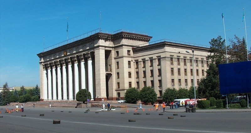
Day 1. Almaty.
Evening arrival in Almaty. A meeting at the airport, transfer to hotel, accommodation, a dinner, overnight.
Day 2. Excursion across Almaty.
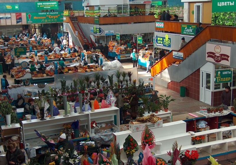
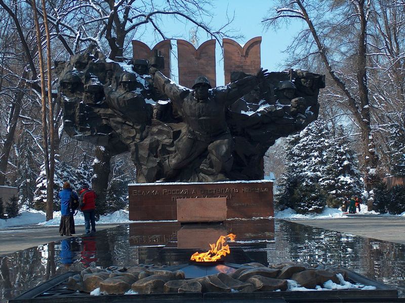
Breakfast. After a breakfast, at 9.00 the beginning of excursion across Almaty. Visiting of the main market of city «The Green market» (1875), here it is possible to feel exotic of east market. After walk on a market visiting of firm shop of confectionery factory "Rakhat" (1942), in shop for you an empire of chocolate and sweets. Foot walk to park 28 guardsmen-panfilovsev (1868), visiting Voznesenskiy of a cathedral of architect Andrei Zenkov (1904), visiting of a memorial of Glory and eternal fire (1975), visiting of a museum of musical instruments (1980).
Transfer to a national historical museum (1985). Visiting showrooms, «a gold room saks", in this museum is gold saks which have been found at excavation of a burial place of the Gold person on barrows in vicinities of settlement Issyk. A lunch at national restaurant. After a lunch walk on mountain Kok-Tobe. Transfer to cable way stations "Kok-Tobe" at a palace of Republic. Rise on cable way on mountain the Kok-Tobe (1070 meters above sea level 1,7 km, 5 minutes).
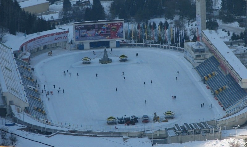
Walk in vicinities of mountain Kok-Tobe. From height of a panoramic platform, the kind on city and mountains Zailiiskiy Alatau opens. Visiting of a small zoo, a monument to group "Beatles", shop of souvenirs, art gallery. Transfer to bus station and the further in valley Medeo (15 km, 30 minutes). In valley Medeo there is a station cable way (2010). Our travel to mountains Zailiiskiy Alatau from here begins.
Rise on cable way from natural boundary Medeo to a high-mountainous ski resort «Shymbulak» (4, 5 km, 15 minutes). It is the third in the world cable way on extent. From height of the bird's flight we shall see vicinities of high-mountainous skating rink Medeo, a dam in gorge Small Almaty. Behind a dam between supports and hangers the cable way the biggest distance and the maximal height cable way. Soon we come nearer to natural boundary Sary-Sai twisting road below. From here the tumbled down trees are well visible, these are consequences of hurricane on May, 17th, 2011.
At rise on ski resort Shymbulak, the magnificent kind on mountains Northern Tien-Shan with tops opens: Tchkalov (3800 m.), Abay (4010 m.), The Schoolboy (3590 m.), Komsomol (4376 m.) . Under us the ice skating rink «Medeo», a dam in gorge Small Almaty, from the right party from us valley Gorelnik, the river Small Almaty, road the leader from Almaty on resort Shymbulak is located. Arrival on a ski resort «Shymbulak». Walk on a viewing platform with a kind on city and neighboring mountains.
Continuation of rise on the second cable way «Kombi-1» on terminal station "Kombi-2" (1,7 km, 10 minutes). Photographing of a panorama of city and vicinities of a mounting skiing resort from a panoramic platform at station. Continuation of rise on the second cable way «Kombi-2» up to pass Big Talgar (3168 m.) (1,5 km, 8 minutes). Walk in vicinities of pass Big Talgar. A buffet table with a champagne. Returning in Almaty. Transfer to hotel. Dinner at national restaurant with folklore show.
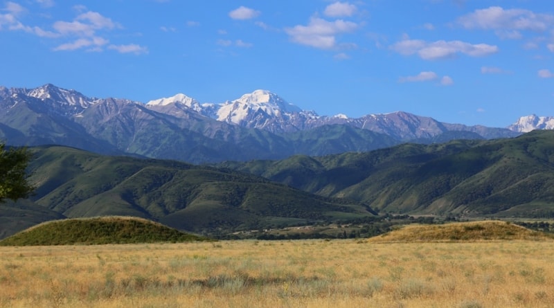
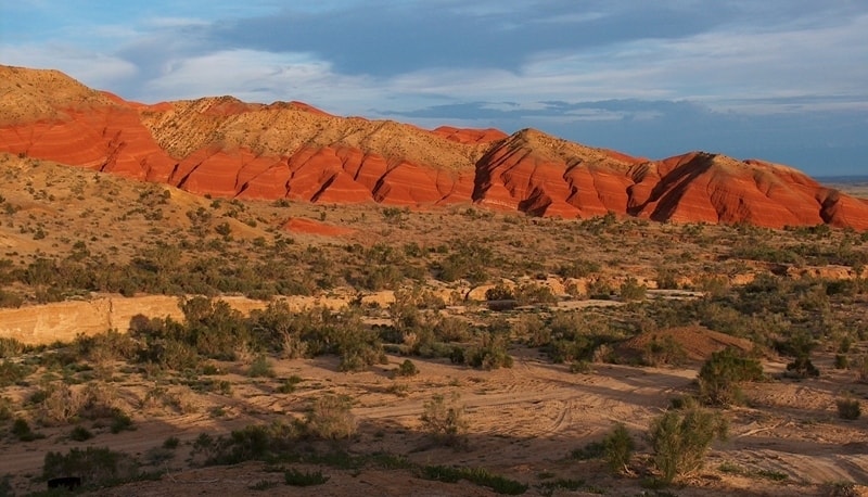
Day 3. Almaty - town of Kapchagay - settlement Shengeldy - settlement Sary-Ozek - pass Altyn-Emel of 1890 meters above sea level - settlement Basshi (351 km).
Breakfast. Transfer to settlement Baschi (255 km). On a way we pass the bridge through the river Ili in vicinities Kapshagay of a water basin and further our way leaves on the east. We pass the second railway station after Almaty and from here our way turns on a southeast in a valley which lasts along east coast of the river Ili. A following interesting place of our way will be Altyn-Emel pass. A stop on pass Altyn-Emel, short walk in vicinities. Arrival in settlement Baschi, official registration of papers on visiting of national park Altyn-Emel.
Crossroads: settlement Baschi - cordon Shagan - cordon Mynbulak - the Singing Barchan (48 km). Walk in vicinities of the Singing barchan, at desire an ascention on sand on top of mountain from sand.
Transfer: the Singing barchan - spring Valikhanov (2 km), descent to a spring, on a legend at a spring stopped Kazakh traveller Shokan Valikhanov, walk in vicinities.
Transfer: spring Valikhanov - stones Oshaktas (8 km). Walk in vicinities stone стел Oshaktas.
Transfer: Oshaktas - cordon Mynbulak (1 km). On cordon Mynbulak it is possible to visit a small pond in which the small family of sazans and other fishes live. Ancient willows, with semicentenial age, also will draw your attention, in a shadow of willows it is possible to have a rest after visiting the Singing barchan and to get drunk cold water from a spring.
The further transfer: Mynbulak - settlement Basshi (37 km). Arrival in settlement Basshi, a dinner, and overnight.
Day 4. Settlement Basshi - burial mound Besshatyr - gorge Terekty (176 km).
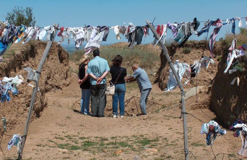
Breakfast. Transfer: Basshi village – burial mound Besshastyr (55 km). Ancient barrows Besshatyr, concern to an epoch of the early Iron Age (VII - VI в.в. Up B.C). Here there are ancient burial places, barrows Besshatyr consist of more than thirty barrows greater and small, in the biggest barrow - Imperial, the leader саков has been buried.
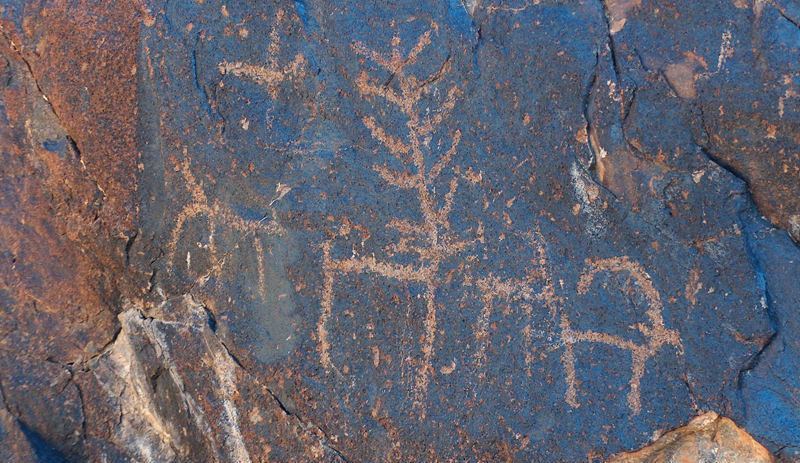
Transfer: burial mound Besshatyr - gorge Terekty (33 km). In this natural boundary are petroglyphs with images of stages of hunting and wild animals. Walk to petroglyphs to figures. Lunch.
Transfer: gorge Terekty - settlement Basshi (88 km). Arrival in Basshi, a dinner and overnight in the guest house.
Day 5. Settlement Basshi - settlement Nurum - settlement Aktobe - mountains Aktau - gorge Katu-Tau - valley Kosbastau (153 km).
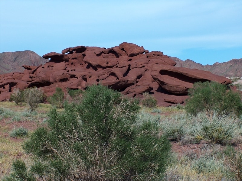
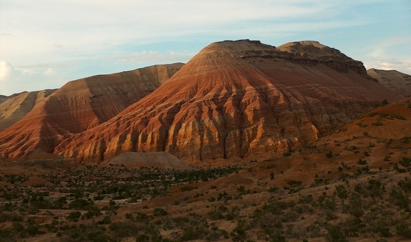
Breakfast. Transfer: Basshi - mountains Aktau (71 km). After settlement Basshi our way is passed two small settlements Nurum and Aktobe after them lays on the east between mountains Aktau and the river Ili. Gradually the country road deduces us to mountains Aktau and the further way passes along southern slopes of mountains Katu-Tau and Aktau. Arrival on multi-coloured mountains Aktau, walk upwards on gorge in vicinities of mountains Aktau.
Transfer: Актау - gorge Katu-Tau (26 km). Arrival on rocky file Katu-Tau, walks in vicinities. Lunch. Transfer: Katu-Tau - cordon-natural boundary Kosbastau (27 km). On cordon Kosbastau there is a small artificial pond and some centenary willows, one of which more than 700 years. Walk in vicinities of natural boundary.
Transfer: Kosbastau - settlement Basshi (29 km). Arrival in Basshi. A dinner and overnight in the guest house.
Day 6. Bashi settlement - canyon Charyn (342 km).
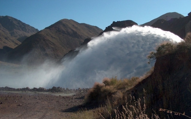
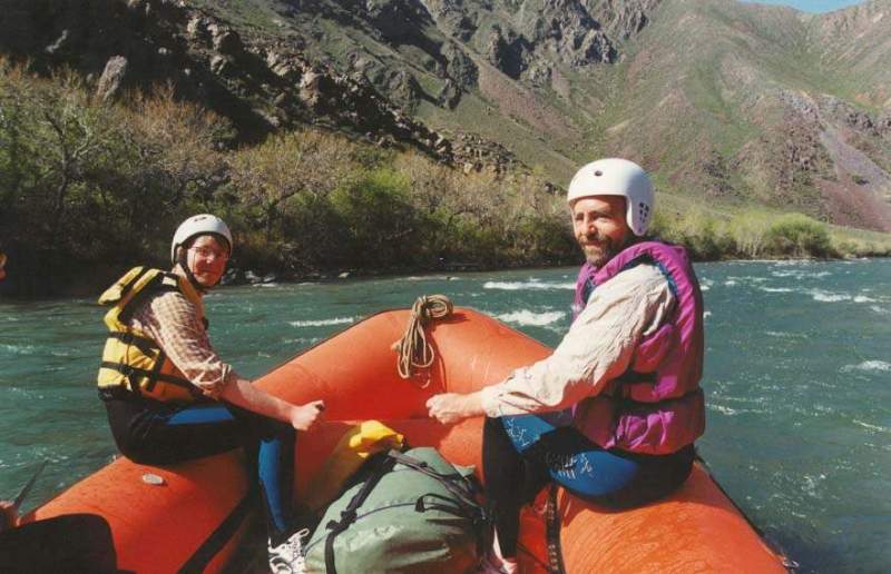
Breakfast. Departure at 8.00. Transfer settlement Basshi - settlement Koktal - the bridge through the river Ili - settlement Chundzha - the bridge through the river Charyn - settlement Kokpek - Bartogai reservoir (1985) (266 km). Arrival on Bartogai reservoir. Transfer through tunnel Bartogai of a dam. Arrival to the beginning of an rafting on the river Chilik, preparation for an rafting.
An rafting on Bartogai to a canyon (12 km, hour). The termination of an rafting in vicinities of settlement Malybaj. Lunch.
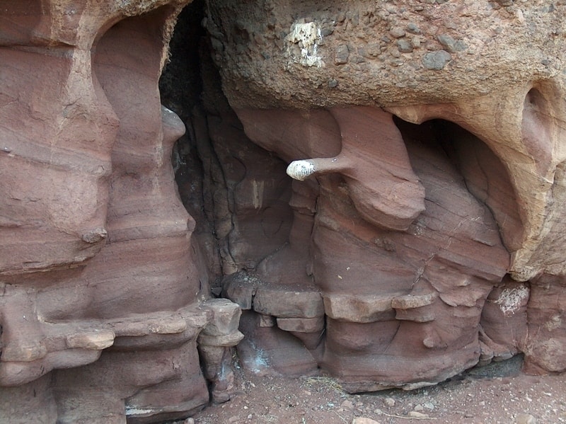
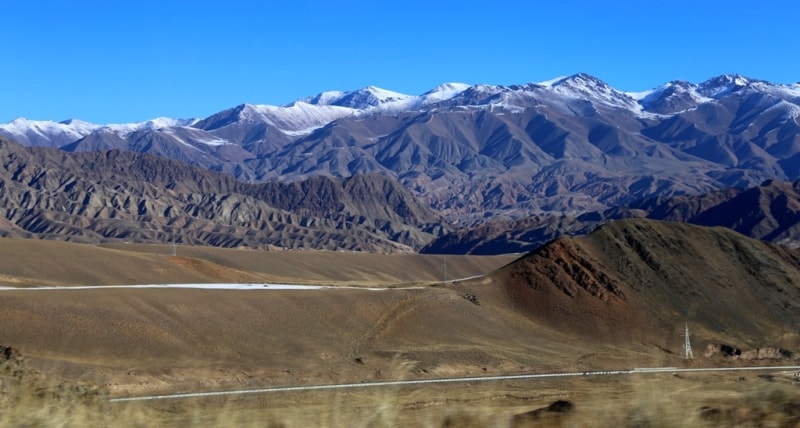
Transfer: settlement Malybai - gorge Kokpek - canyon Charyn (52 km. 1,5 hours). Arrival on canyon Charyn, walk to the river Charyn. Charyn the canyon is ensemble of palaces, towers and minarets. About such shape the gorge has reached nearby 500 000 years back. So there was «Valley of locks» - one of masterpieces of natural architecture. On slopes there are the numerous rests of mineral fauna dated bottom Carbonic period nearby 300 million years ago.
Since prehistoric times of water Charyn - the largest inflow of the river Ili - laid to itself a waterway among rocks, forming in rocks a huge canyon. The termination of walk. Transfer: canyon Charyn - the bridge through the river Charyn (24 km.). Accommodation in a tourist camp. A Scythian bath on coast of the river Charyn. Dinner, a fire. Overnight in tents.
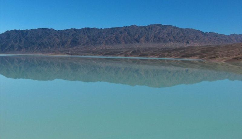
Day 7. River Charyn - lake Kaindy - lake Kolsai-I (133 km).
Breakfast. Transfer: river Charyn - a panoramic platform on the river Charyn (10 km). Walk, photographing. Transfer: a panoramic platform on the river Charyn - settlement Zhalanash - lake Kaindy (97 km). Arrival on lake Kaindy, walk in vicinities. Lunch.
Transfer: lake Kaindy - settlement Saty - lake Kolsai - I (26 km). Arrival in the guest house at lake Kolsai - I, accommodation. Walk in vicinities of lake. Dinner and overnight.
Day 8. Lake Kolsai-I - lake Kolsai-II (9 km + 9 km = 18 km).
Breakfast. Today we shall make walk on lake Kolsai - II 2252 meters located at height above sea level. This lake is in nine kilometers from lake Kolsai-I. The track passes on the left coast of lake from a track magnificent kinds on lakes Kolsai and neighboring mountains open. The fish lives in lake Kolsai - a royal trout. From the south the river Kolsai, lake runs into lake more than two kilometers in length, depth of lake up to 80 meters. The most beautiful lake Kolsai-II is in an environment of high mountains. Lunch on lake, returning in the guest house, dinner and overnight.
Day 9. Lake Kolsai - settlement Kegen - check point «Kegen» - city of Karakol (289 km).
Breakfast. Transfer: lake Kolsai - settlement Kegen - check point «Kegen» (178 km). Arrival on a check point «Kegen». Going through formalities of boundary service of Kazakhstan and Kyrgyzstan. The further transfer: check point «Kegen» - pass San-Tash (21 km) (in translation «Consider stones»). A stop on pass the San-Tash walk in a vicinity of stone mountain the San-Tash, walk at memorable sign Shokan Valikhanov.
The further transfer: pass the San-Tash - settlement Tyup - museum Przhevalskyi (78 km). Our way lays in Issyk-Kul a hollow. Visiting of a museum of M.N.Przhevalskyi, a tomb of the great traveller on high I protect lakes Issyk Kuls, walk on park. Transfer to the city of Karakol (12 km). Arrival in the city of Karakol, transfer to hotel, accommodation. Dinner in dungan to family and overnight.
Day 10. Karakol - gorge Dzhety-Oguz - settlement Tamga (175 km).
Breakfast. After a breakfast visiting of a masterpiece of wooden architecture Dungan of a mosque (1907) and Troisk wooden orthodox church (1895). Transfer: Karakol - settlement Dzhety-Oguz - gorge Dzhety-Oguz - valley «Seven Bulls» 2200 meters above sea level (36 km).
Foot walk on a panoramic platform which towers above valley «Seven Bulls» and resort "Dzhety-Oguz" (1 km, 1 hour). Walks at the river Dzhety-Oguz and at a rock «The Broken heart».
Transfer: valley «Seven bulls» - valley Kok-Zhaiyk (7 km). Walk in vicinities of valley, walk in the Valley of colors. Here in 1973 spent trainings the Soviet cosmonauts in conditions middle altitude, there lived cosmonauts in sanatorium "Dzhety-Oguz". Lunch in yurt acquaintance to the Kyrgyz kitchen.
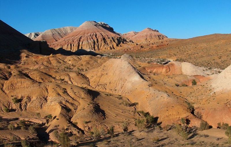
After a lunch transfer: valley Kok-Zhaiyk - settlement Kyzyl-Суу - gorge "Fairy tale" (114 km). Walk in gorge "Fairy tale" (1,5 hours). In gorge we shall see fallen asleep in unusual forms, eruptions of multi-coloured breeds of the brightest contrast shades, is motley embroider firm limestones and the sandstones, similar to ruins of ancient locks or skeletons of prehistoric monsters. The termination of walk.
Transfer: gorge "Fairy tale" - settlement Tamga (17 km). Arrival in settlement Tamga, accommodation in the guest house, dinner and overnight.
Day 11. Tamga - lake Song-Kul (329 km).
Breakfast. Transfer: Tamga - southern coast of lake Issyk Kul - settlement Kochkorka (199 km). The settlement Ottuk will be the last at southern coast of lake Issyk Kul, thus we shall see all southern part of lake in the extent hardly more than 200 kilometers. After we pass lake Issyk Kul ahead of us will meet and spends one of large reservoir Issyk-Kul of a hollow - Orto-Tokoi.
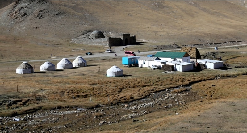
Arrival in settlement Kochkor, visiting of a craft workshop and of a museum of an applied art. The further transfer: settlement Kochkorka - pass Kalmak-Ashuu of 3446 meters above sea level - lake Song-Kul of 3106 meters above sea level (130 km). Arrival on lake Song-Kul, accommodation in yurt camp, dinner and overnight.
Day 12. Lake Song-Kul - caravanserai Tash-Rabat (174 km).
Breakfast. It is one of picturesque mountain roads, some passes who will be on our way will add our travel by beautiful kinds of mountains Kyrgyzstan, on a way we shall visit yurts shepherds, we shall try the Kyrgyz national drinks - kumys ans airan. Transfer: lake Song-Kul - pass Moldo-Ashuu of 3201 meters above sea level (22 km). A stop on pass, walk in vicinities, photographing of a panorama of gorge Kurtka. Transfer: pass Moldo-Ashuu - mausoleums Atanbai-batyr (1796-1837) and Tailyuk-batyr (1796-1838) (31 km), walk at historical monuments, photographing.
Transfer: mausoleums Atanbai-batyr and Tailyuk-batyr - village Baetovo - caravanserai Tash-Rabat (121 km). Arrival to caravanserai Tash-Rabat, visiting of premises a caravanserai, walk in vicinities. In 1895 at returning from Kashgar to city Vernyi, caravanserai Tash-Rabat, has visited and the Kazakhstan explorer Shokan Valikhanov has made the brief description. After visiting a caravanserai transfer to yurts to camp in the beginning of gorge before a picturesque rocky gate in a spur of a ridge at height about 3000 meters above sea level, accommodation, dinner and overnight.
Day 13. Valley Tash-Rabat - check point «Torugart» - city Kashgar (280 km).
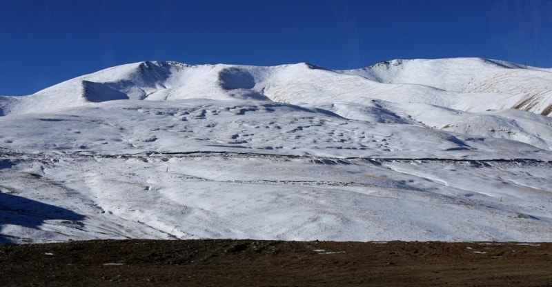
Breakfast. Transfer: Tash-Rabat - pass Ak-Beiit of 3281 meter above sea level - pass Tyuz-Bel of 3574 meters above a level - check point «Torugart» 3752 meters above sea level (110 km). Departure at 7.00. We come back to a highway Bishkek - Torugart, we turn on the left and we move in a southwest direction to the Kyrgyz-Chinese border.
Arrival on a check point «Torugart». Going through formalities customs and passport control on the Kyrgyz check point. Transafer on the Chinese customs and a boundary post (7 km). A meeting with the Chinese partners. Transfer: check point «Torugart» - city of Kashagar (170 km). Arrival in Kashgar, transfer to hotel, accommodation. Excursion on city. Dinner and overnight.
Day 14. Kashgar.
Breakfast. Visiting of historical places of interest of city:
- mosque Id-Kah - one of the greatest in the Central Asia. For a Friday pray in a mosque gathers up to 10 000 person. The mosque has been constructed in 1442 under the order of the governor of city of Kashgar Shakessimirdzhoi (IX - X с.с.). A mosque, encrust yellow coating a tile. The central dome of a mosque is decorated by a minaret. The Islamic architecture distinguishes it from other mosques executed in the Chinese style, and the grandiose size is combined with exclusive grace.
- Tombs Khadzhi Abakh. This family tomb - is located in 5 km to northeast from downtown. Tomb Khadzhi Abakh - the powerful governor of Kashgar of XVII century has been constructed in 1640, 5 generations of its big family here are based. The ritual complex consists of several magnificent buildings where the Sepulchral hall is central. It can be learned easily on a huge dome in diameter of 17 meters, encrust green coating a tile.
The dome and a minaret are similar in Indian Tadzh-Makhal in a miniature. Inside of a hall, the height of 26 meters and length of 39 meters, are some tombs, each of which is covered by a fabric of different color. Constructed of coating a brick, tombs are decorated by a bright flower ornament on a white background. Tombs of the greater size belong to men, smaller - to women.
- East market. The market in Kashgar represents the biggest trading market in the south of Sinzyan-Uigur independent area. This place of a congestion of different production and people, has many names, including and such: «Exhibition of an exchange of the goods of the Central and Western Asia» - as it inhabitants of Kashgar name. Besides the status of a huge souvenir bench and a huge warehouse of products, he also is also the important tourist place of interest of city.
East market in Kashgar settles down on east I protect the rivers Tuman in a northeast corner of city. On a market is more than 5000 trading counters where it is possible to get various fabrics, clothes, footwear, headdresses, food stuffs, dried fruits, craft products, etc.
- the mausoleum of princess Syanfei. Syanfei (a Turkic variant of its name - Iparkhan) was the second wife of emperor Tsyanlun from a dynasty Sin. The mausoleum is dated 1640. In Sinzyan the legend about fine princess, the daughter of Turkic khan who not only was able to sing and dance beautifully is widespread, but also perfectly owned fighting art U-shu. The Chinese emperor Tsyanlun has passionately fallen in love with the girl, has brought it to Beijing and has presented with set of riches.
Princess has spent in Forbidden city of 28 years, never saw the family and, not having sustained an imprisonment in «a gold cell», has died in the age of 55 years. It it has been decided to bury on the native land. The funeral procession with a sarcophagus on a special gun carriage of more year followed from Beijing to Kashgar where it and have buried.
- the huge statue great Мао Szedun, settles down in downtown - on the main area.
Transfer to airport. Flight to Urumqi in the afternoon. Then transfer to Turfan, Dinner at national restaurant transfer to hotel, overnight.
Day 16 day. Turfan – Urumqi (200 km. 2 – 3 hours).
Breakfast. Excursion on Turfan. Turpan was an oasis in the northern part of the Silk Road for many centuries. En route, the many stops to admire the view of the Massif Central. AM: Visit Jiaohe ruins directly. Jiaohe ruins dates from Ist BC and flourished around Vth AD.
Much of the city structure is understandable with well laid out city plan the administrative section to housing settlement and to the secular parts with surviving Stupa ruins. It was part of Tang Dynasty in VIIth AD continued under successive domination till XIIIth AD when the Mongols destroyed the city.
Visit the impressive ruins at Gaochang ancient city (47 km), built in the IInd c. BC, it became the capital of the Kingdom of Gaochang under the Han dynasty, destroyed around XIVth century, take a donkey cart taxi to venture deep into this famous ancient site. Get inside of Astana Tombs to see well preserved mummies and unique wall paintings dated back to IIAD. Then visit Kanel irrigation system. Transfer to Urumchi. Overnight.
Day 17 day. Urumqi.
Breakfast. After breakfast transfer to airport, departure from Urumqi.
Technical description of rafting part on Chilik river (Bartogay canyon).
Length – 20 km, duration of rafting – 3 hours.
Complexity – III with elements of IV category when evacuation of water through locks from Bartogay reservoir is 60 - 80 cubic meters per sec.
Complexity – IV with elements of V category when evacuation of water through locks from Bartogay reservoir is 100 - 120 cubic meters per sec.
River inclination - 7 - 8 meters per 1 km.
During 30 - 35 min after start of rafting – river is relatively quiet with periodic sand-spits with powerful billows.
Rapid №1. Is billows more 1m with sharp turn of river to right and pressing to right-bank, then river fluently becomes level. There are 2 powerful flows and one hole and it is very important – to come in rapid. There are 2 - 3 poured over stones in river bed more to the left of main flow.
Rapid № 1 with typical inclination of water 3 m per each 30 m. Rapid begins in 40 - 50 min after rafting start, length of rapid is more 100 m. After rapid № 1 river is continuous sand-spit with powerful billows more than 1 meter in height. Token of rapid – inclination of water with suddenly turn of river to right. End of rafting at Malybai village.


The note:
Author program is Alexander Petrov. Copying and use - from the sanction of the author petrovsra@mail.ru
Alexander Petrov
photos by.