


You are here
Rivers in Central Asia.


Tours along rivers of Central Asia.
“Nature is wise. You can learn everywhere and from everything”
Leonardo da Vinci.
Travels on rivers of Central Asia.
The territory of Central Asia and Central Kazakhstan, with the exception of high-mountainous regions, has insufficient and, for the most part, extremely insufficient moisture. Associated with this is the extremely large for the territory of Central Asia, the rarefaction of the hydrographic network, the exceptional importance of the exotic, that is, not characteristic of the desert landscape, rivers originating in the high mountains, and the incompetence of most of the territory.
The density of the river network in the desert plains of Central Asia is about 2 meters per kilometer square, while, for example, in the northern half of the Russian Plain it reaches 300 – 350 km / h of square kilometer.
The rivers of the main part of the territory, except for the northern half of Central Kazakhstan, end in inland lake water bodies (the Caspian Sea, Aral, Balkhash, Issyk-Kul, etc.) and small lake-marsh spills or have so-called dry deltas - in this case water of the rivers, not reaching large lakes or large river arteries, it is spent on evaporation, infiltration into the ground and mainly on irrigation of fields.
There are no rivers with a constant flow that would begin in the desert zone of the flat part of Central Asia. Exceptions are small streams (Karasu), fed by the springs of the outer edge of mountain trails. Only in the north, within Central Kazakhstan, there are permanent streams of local origin.
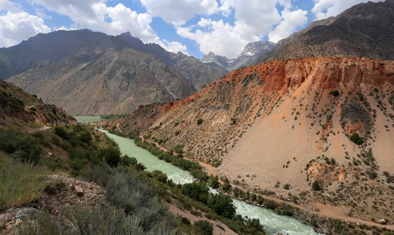
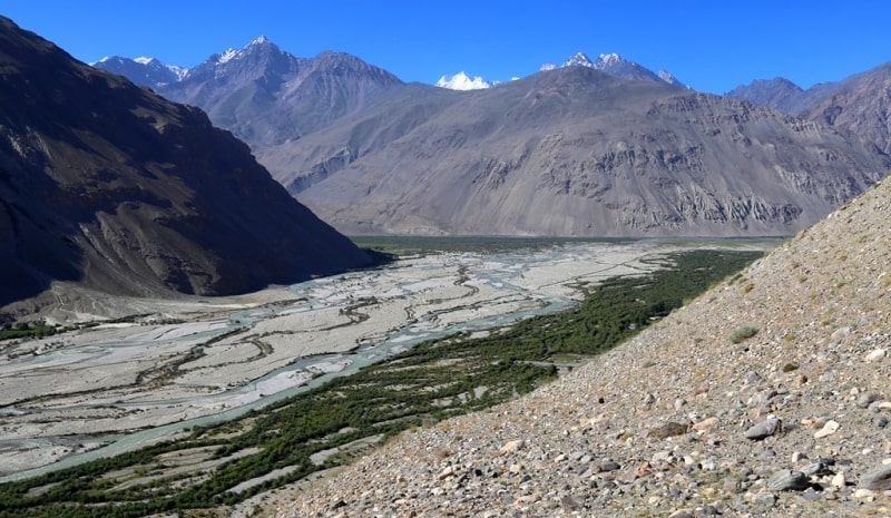
In the mountains, starting from about 700 meters of absolute height, precipitation falls in large quantities in the form of rain and snow (in the highlands even in summer). The maximum amount of precipitation (up to 2000 mm per year) is observed at altitudes of 2000 - 3500 m, and their number decreases.
The runoff coefficients in the high-altitude zone of maximum humidification are large, ranging from 0.6 to 0.8, and in some places approaching unity. The predominance of the steep slopes of the ridges, mostly composed of crystalline and metamorphic rocks and often devoid of land cover, provides abundant and rapid flow of rainwater and, in particular, thawed snow waters into river valleys.
The river network here is most developed. Its density in the Tien Shan reaches more than 600 square kilometers. Liquid precipitation and melt water not only form surface runoff in the mountains, but also partially seep into fractured and porous rocks, feeding groundwater.
Mountain slopes oriented to the west and south-west and not protected on this side by other mountain barriers, i.e., accessible to moisture for air masses, have the greatest importance in the formation of runoff. The main role in the formation of surface and groundwater runoff in Central Asia belongs to solid precipitation, since much of the moisture that falls in the form of rains in summer evaporates.
The main source of power for the rivers of Central Asia is the meltwater of the high-mountain snows.
Glacial feeding is significant only in the upper reaches of those rivers, the main catchment area of which is occupied by glaciers and snow fields (especially in the Pamirs). When the rivers leave the mountains, the share of glacier feeding usually does not exceed 25% of the annual volume of flow, and in the total annual flow of all Central Asian rivers, it is only slightly more than 6%.
In the mountains, a significant role in feeding rivers belongs to groundwater (in most rivers they make up 10 –2 5% of the annual flow, in some up to 50%). The rivers of Central Asia are an important landscape forming factor.
Along with the cultural landscapes of the riverine oases in the river valleys, special natural complexes are formed with their microclimate, with dense tree-shrub riparian woodland (tugai) thickets, with special soils and a special fauna composition.
Rivers feed and desalinate groundwater in adjacent desert areas. Most of the rivers of Central Asia, especially large ones, have mixed glacial snow feed. These are rivers starting in the highlands. Their floods occur during the period of the most intense melting of glaciers and snow in the high mountains, that is, during the summer months (June, July, and early August).
It is often preceded by a secondary flood (April - May), associated with the melting of seasonal snow in the lower horizons of the mountains. Rivers of glacier-snow feeding are characterized by small fluctuations in annual runoff and high water stretched in time, which, together with a steep fall of the riverbed, makes them especially valuable for economic use - irrigation and hydropower.
Small and medium-sized rivers, whose sources are located on the mountain slopes below the snow line or in the mid-high mountains, feed on melt snow water and have a spring flood (March, April, in the north - May). Small rivers, starting in the lowest tiers of mountains that do not have a steady snow cover, mainly in the south of Central Asia, have mainly rainwater and flood regimes. On these rivers often formed destructive mudflows.
Groundwaters, whose role is especially great in winter, take part in the feeding of rivers of all the types listed. The rivers of Central Kazakhstan feed mainly on spring thawing of seasonal snow and partly on account of groundwater; spring floods from them.
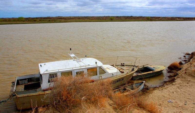
The largest waterway of Central Asia - Amu Darya (length - 2540 km) begins on the northern slope of the Hindu Kush, in the upper reaches it is called Vakhandarya, and after the confluence with the Pamir River - Pyanj.
From the place of the confluence of the Panj and the Vakhsh, the river is called the Amu Darya. Soon, it receives to the right the tributaries Kafirnigan, Surkhandarya and Sherabad, and then for 1257 km, up to the mouth, does not receive more than a single tributary. Here, a significant proportion of its flow is spent on irrigation, evaporation and infiltration.
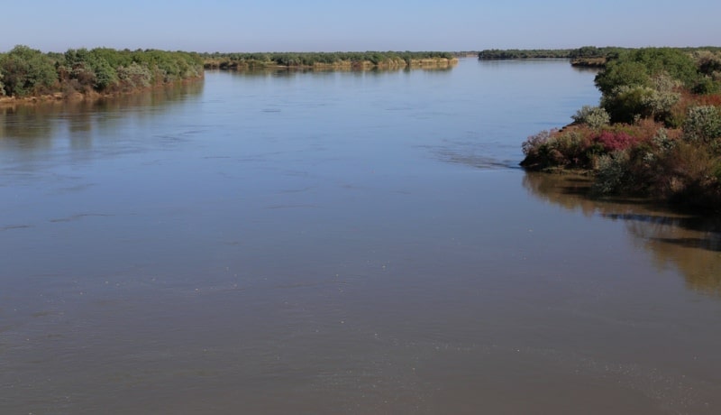
The low, mostly river banks have a dam system that protects fields from flooding during floods. The width of the channel during low water is 1 - 3 km. Near the city of Nukus, in the area of the ancient delta, the Daryalyk (Kunyadarya) dry sleeve leaves the Amu Darya, through which formerly part of the Amu Darya waters flowed into the Sarykamysh depression and through it into the ancient bed of Uzboy.
The runoff on Uzboy to the Caspian Sea was periodically carried out back in historical time, as mentioned by medieval authors. Below Nukus begins the modern Amudarya delta - a slightly sloping plain with many ducts.
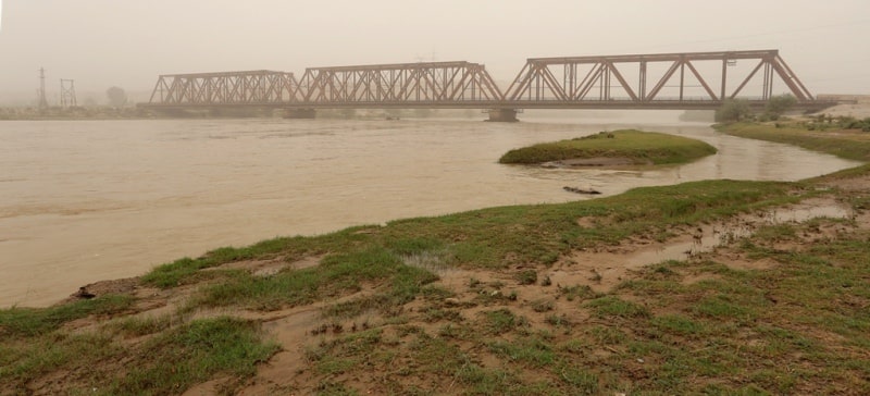
The bed of the Amu Darya in the lower reaches is very variable, which is associated with the speed of flow and easy erosion of the soil of the shores. The volatility of the river bed hampers navigation and water intake in irrigation canals.
In the lower reaches of the Amu Darya, the Tyuyamuyun reservoir was created for irrigation purposes. The rivers of Central Kazakhstan feed mainly on spring thawing of seasonal snow and partly on account of groundwater; spring floods from them.
The largest waterway of Central Asia - Amu Darya (length - 2540 km) begins on the northern slope of the Hindu Kush, in the upper reaches it is called Vakhandarya, and after the confluence with the Pamir River - Pyanj.
From the place of the confluence of the Panj and the Vakhsh, the river is called the Amu Darya. Soon, it receives to the right the tributaries Kafirnigan, Surkhandarya and Sherabad, and then for 1257 km, up to the mouth, does not receive more than a single tributary.
Here, a significant proportion of its flow is spent on irrigation, evaporation and infiltration. The low, mostly river banks have a dam system that protects fields from flooding during floods. The width of the channel during low water is 1 – 3 km.
Near the city of Nukus, in the area of the ancient delta, the Daryalyk (Kunyadarya) dry sleeve leaves the Amu Darya, through which formerly part of the Amu Darya waters flowed into the Sarykamysh depression and through it into the ancient bed of Uzboy.
The runoff on Uzboy to the Caspian Sea was periodically carried out back in historical time, as mentioned by medieval authors. Below Nukus begins the modern Amudarya delta - a slightly sloping plain with many ducts.
The bed of the Amu Darya in the lower reaches is very variable, which is associated with the speed of flow and easy erosion of the soil of the shores. The volatility of the river bed hampers navigation and water intake in irrigation canals.
In the lower reaches of the Amu Darya, the Tyuyamuyun reservoir was created for irrigation purposes. The energy potential of the Central Asian rivers has been used to a small extent, although hydroelectric power stations have already been created on many rivers.
Extensive surveys are being conducted and the energy of large mountain rivers is being partially used. The At-Bashinskaya, Uchkurgan and Toktogul hydropower stations are built on the Naryn, the Kurpsay hydropower plant is under construction, preparations are underway for the construction of the Tash-Kumyr hydropower station, and design penalties are being built to build the Kambarata hydropower unit in the Tian-Shan cascade.
Several hydroelectric power plants are projected on the tributaries of the Naryn. The large Nurek hydroelectric power station with a dam of almost 300 meters in height was built on the Vakhsh River; In the future, it is planned to build six more hydropower plants of the Vakhsh cascade.
The dam of the Rogun hydropower plant will rise even higher than the Nurek one. Research is being conducted on the hydropower development of Pyanj, where it is planned to create a cascade of eight hydroelectric power plants (Dashtidzhumskaya, Nizhnepyandzhskaya and others).
The Kapchagai hydroelectric station with a large reservoir was created on the Ili River. Energy problems are solved simultaneously with irrigation problems. The construction of large reservoirs on many Central Asian rivers leads to a wide regulation of river flow.
Many reservoirs have been created, new ones are being built and designed. For gravity irrigation, sharp kinks in the longitudinal profile of the rivers when they leave the mountains on the plains and the “convex shape of the river valleys” are favorable, that is, the elevation of the beds of large rivers above the surrounding plains in the lower reaches.
Especially important is that, flowing through low desert plains, rivers have high water at the height of summer, that is, just at the same time that not a drop of rain falls in the south of Central Asia, and the cultural vegetation is in the phase of the most vigorous growing season.


Authority:
N. A. Gvozdetsky, N. I. Mikhaylov. "Physical geography of the USSR. Asian part. The edition third corrected and added. Moscow "Thought" of 1978. http://tapemark.narod.ru/geograf/1_5_5.html
Photos by
Alexander Petrov.