


You are here
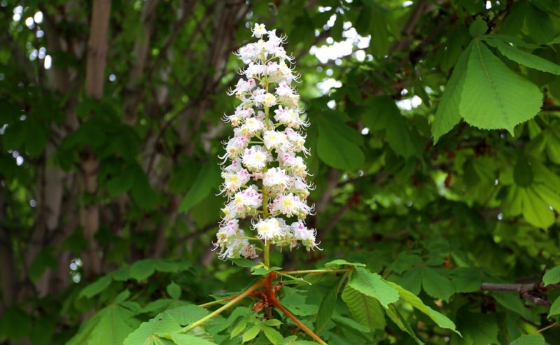
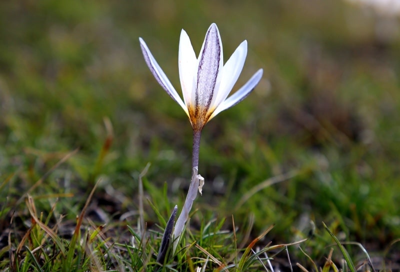
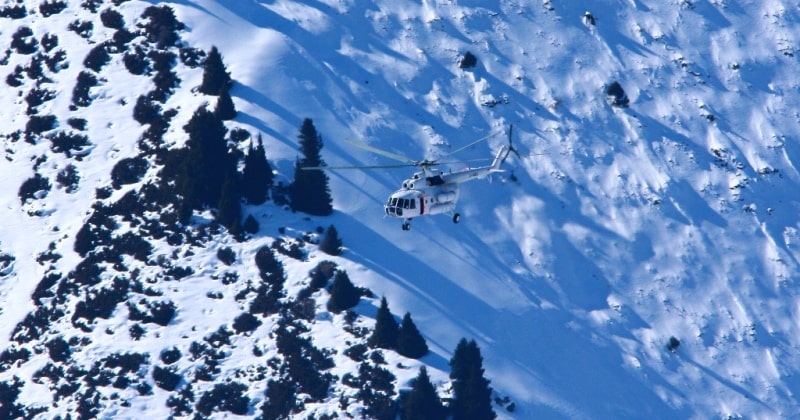
History peak Korzhenevskay.
 Photo L. Opukhovskogo.")


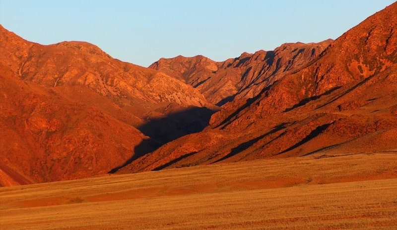
Travel to Pamir in Tajikistan.
“Climb the mountains and get their good tidings. Nature's peace will flow into you as sunshine flows into trees. The winds will blow their own freshness into you, and the storms their energy, while cares will drop away from you like the leaves of Autumn”
John Muir. «The Mountains of California».
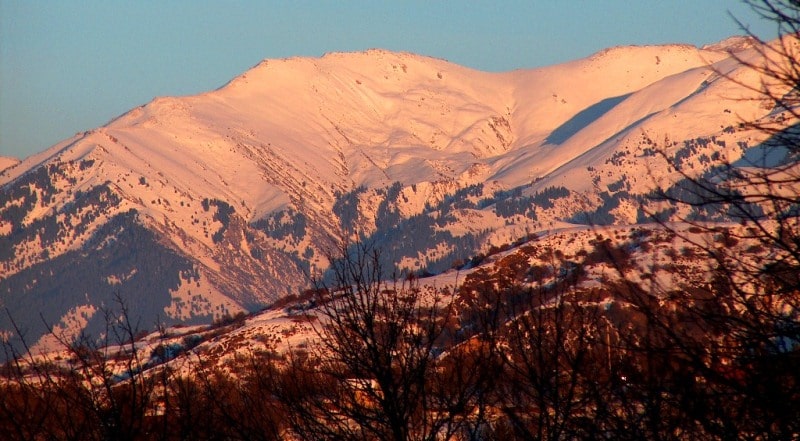
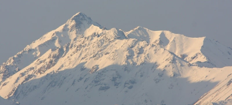
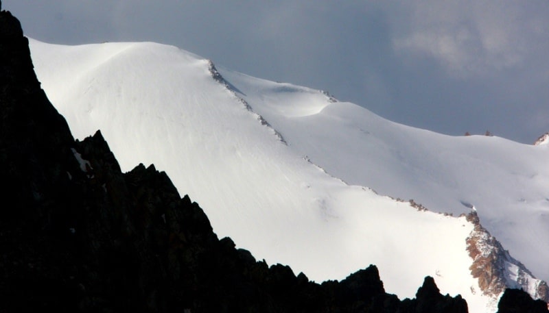
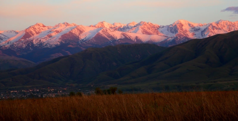
Pamir Mountains in Tajikistan.
The peak of Evgenia Korzhenevskaya was discovered and mapped by the famous explorer of mountainous regions of Central Asia, geographer and glaciologist N.L. Korzhenevsky in 1910. Back in 1904, having set as its goal the investigation of the then mysterious Pamir, N.L. Korzhenevsky takes his first trip to the upper river. Muksu.
At that time, it was known that this powerful river, one of the sources of the deep-water Vakhsh, originates in the greatest glaciers of the Pamirs. The most significant of them was discovered in 1878 by the entomologist and geographer V.F. Oshanin and named them Fedchenko glacier in honor of the famous researcher Pamir-Alai.
Narrow and deep valley. Muksu is bounded on the north by the slopes of the Zaalai Range. To the south of it, the snow giants of Peter the Great ridge rise, also open to VF. Oshanin in 1878. By the time of the first expedition of N.L. Korzhenevsky information about the orography of the Peter the Great range was very scarce, and the traveler hoped to collect more complete data during his itineraries.
In September 1904 N.L. Korzhenevsky, together with an explorer, a Kirghiz Tokhtur-bai, made his way out of the village of Altyn-Mazar in the headwaters of Muksu downstream. With the greatest difficulties, they managed to walk along the breathtaking hiking trails through the wild gorge of the r. Muksu until its merger with the river.
Kzylsu in the Tajik village Damburachi. In the report of his travels N.L. Korzhenevsky gave a detailed description of the march route scheme of the mouths of the right and left tributaries of the Muksu, information about the traces of the ancient glaciations of the basin.
Of considerable interest were his reports about the then-unknown powerful science of modern glaciations on the northern slopes of the Peter the Great Range. One of these glaciations was discovered by a traveler 25 kilometers west of Altyn-Mazar. N.L. Korzhenevsky, looking at the gorge that had opened on his left, drew attention to the powerful terminal moraines and the language of a large glacier, rising from the south close to the valley of Muksu.
According to Tokhtur Bay, it was Karasel glacier. The researcher then limited himself to a cursory examination of the glacier tongue from the r. Muksu; he couldn’t follow the continuation and look at its headwaters due to bad weather and low clouds. N.L. Korzhenevsky therefore hoped to explore the Karasel glacier, which he later called Mushketov glacier.
However, the difficulties of traveling down the Muksu valley undermined the traveler’s strength, and the attempt to survey the newly opened glacier had to be postponed for six years. In August 1910 N.L. Korzhenevsky, together with his companion, Dr. MP Bogdanov, again penetrates to the headwaters Muksu.
On August 21, they marched to the ice language Fedchenko. The next day, it was decided, together with the pro ‑ waterman, Uzbek Halmet, to attempt to inspect the Mushketov glacier from the right slope of the Muksu valley; the crossing to the left bank, to the tongue of the glacier, turned out to be impossible because of the high water.
Unlike the first hike, the weather was warm and sunny. Moving on a trot on horseback, the group reached the Doradek tract two hours later. There were two wintering here, the last traces of Kyrgyz settlements in the upper reaches of the river.
Soon the horse trail was cut short, and further movement became possible only on foot, along a barely noticeable path. Half an hour later N.L. Korzhenevsky and Khalmet were abeam the gorge of the Mushke tov grave.
The cloudless weather allowed a glimpse into the upper reaches of the glacier, and an unforgettable panorama of the spurs of Peter the Great ridge, covered with a powerful snow-ice shell, opened before the explorer.
“The first thing that struck me,” NL wrote later. Korjevsky giant ice massif, towering in the background of the Karasel gorge. The smooth surface of its crest was carried away by at least 20,000 p. (about 6100 m. - Ed.) in height and brightly glittered with powerful ice, which, in all likelihood, feed the Karasel Glacier.
From us, this peak was about 20 versts, and one should think that the glacier has approximately the same extent. I dedicate this magnificent peak to Evgenia Sergeevna Korzhenevskaya, with whose name woven feelings of my gratitude for your kind participation in my travels.”
N.L. Korzhenevsky made serifs from the right bank of the r. Muksu and determined the location of the Mushketov glacier, to the language of which was no more than two versts. The visible contours of the glacier, the slopes of its gorge and the peak of Korzhenevskaya were marked on the first map of this area, attached to the report.
Comparison of information N.L. Korzhenevsky on the location and height of the newly opened peak with modern cartographic data shows that the primary investigator, in his basic definitions, was close to the truth. However, some of his assumptions about the orography of the peak region did not materialize.
The assumption of the connection of the headwaters of the Mushketov Glacier through passes with the r. Hingou. These errors and the limitations of the first information about the peak of Korzhenevskaya are natural. At that time, the vast spaces of the high-mountainous Pamir, lying for many tens of kilometers to the south of Muksu, up to Pyandzh, were not yet investigated and were marked on the geographic maps of Central Asia as a “white spot”.
As a result of the work of Korzhenevsky in 1904 and 1910. managed to get only some data on the northern slopes of the giant peak; complete information about the glaciers of this site, the location of the Korzhenevskaya peak and the location of its ridges could only be obtained as a result of sorties deep into the “white spot”.
But this work under the conditions of the royal order was impossible even for such a bold and persistent researcher as N.L. Korzhenevsky. It was fully resolved only during the years of the Soviet power to a new generation of geographers and researchers of the high-mountainous Pamirs, who relied on the experience of their predecessors.
In 1928, the Academy of Sciences of the USSR organized the First Pamir Expedition, which set its main task to survey the highest ranges of the Western Pamirs, which also included the Fedchenko Glacier area. Thanks to the persistence of the expedition teams, which included experienced climbers, they managed to make a number of geographic discoveries.
It turned out that the Fedchenko glacier extends far into the depths of the unexplored region of the Pamirs and occupies one of the first places among the mountain glaciers of the world by its length. The expedition of 1928 practically proved the possibility of communicating the headwaters of Muksu through the passes of the Fedchenko ice basin with the right tributaries of the middle course of the r. Panj, however, her work did not provide new information about the location of the mountains to the west and north-west of the ridge of the Academy of Sciences, the region, including the area of Korzhenevskaya peak.
In 1929 and 1930 expeditions of the Academy of Sciences of the USSR continued the systematic study of the basin of the right tributary Muksu - p. Sauksai, originating from the southern ice of Lenin Peak. In 1931, a reconnaissance of the southwestern margin of the “white spot” took place - the Sugran, Garmo and Gando glaciers.
But this time it was not possible to determine the relative position of the headwaters of these glaciers and the region of Korzhenevskaya peak, to explain the contradiction of the data obtained earlier when observing the Garmo peak from the east and from the west, which was then considered the nodal vertex.
The mystery of the Garmo knot was resolved only in 1932, after the results of the work of several detachments of the Tajik expedition of the USSR Academy of Sciences were brought together. It was found that the powerful trapezoidal peak with a height of 7495 m, the highest point of the USSR, called Stalin's peak, is located at the junction of the meridional ridge of the Academy of Sciences and the latitudinal ridge of Peter the Great.
The survey found that Stalin’s peak has nothing to do with Garmo’s peak. The expedition of 1932 also resolved the main issues of the orography of the mountain site of Evgenia Korzhenevskaya Peak; detachments of topographers and climbers surveyed the icebreakers Fortambek and Mushketov, visited the headwaters of their main tributaries, determined that the peak of Korzhenevskaya is located in the north-western spur of the ridge of the Academy of Sciences near Stalin peak; the distance between them is slightly more than 13 km.
The powerful glaciation of the peak of Korzhenevskaya belongs to the bas sainam of the Fortambek and Mushketov glaciers. The valleys of these glaciers and their lateral tributaries cut deep into the mass of the peak, forming steep, often steep slopes; elevation differences reach 3000 - 3500 m.
The topographic detachments of the expedition were the first maps of this area. The height of the peak was initially determined at 7050 m, then at 6922 m the most reliable geodetic measurements of recent years determine its height at 7105 m.
The Korzhenevskaya peak was thus one of the highest peaks of the Soviet Union and until recently was considered its third 7,000ths Starting from 1932, the conquest of this peak has become the goal of altitude climbers.
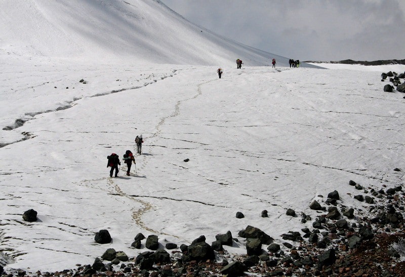
In 1933, the first ascent to the peak of Stalin was made, in 1934 - to the peak of Lenin, in turn was the peak of Korzhenevskaya. The possibility of climbing the Korzhenevskaya peak from the basin of the Mushketov Glacier seemed unlikely. In 1932, a glacier up to the headwaters was surveyed by participants of the Tajik expedition of the Academy of Sciences - alpinist V.D. Nedokladov and geologist A.N. Soldatov.
They reported that the slopes adjacent to the eastern and north-western summit ridges of the peak are very steep, avalanche-dangerous, and attempts to climb to the summit from here are hardly possible. It was necessary to take into account the difficulty of approaching the language of the Mushketov Glacier.
The sole passage of the ford to the left bank of the Muksu at the Doradek site was impassable until September; Approaches to the language of the Mushketov Glacier along the left bank from the lower reaches of Muksu along the tracks of the miners are extremely difficult and hardly passable for load transport.
The first acquaintance of climbers with the upper reaches of the Fortambek glacier in 1932 and 1933. also did not bring comforting results. It was found that the southern slopes of the Korzhenevskaya peak and its southeastern ridge, leading to the peak of the Four, abruptly cut off to the headwaters of the Moskvina1 glacier by vertical two-kilometer walls.
In September 1936, a mountaineering group worked in the upper reaches of the Fortambek glacier, scouting routes to the peak of Stalin from the north. Its structure included instructors of the campaign, whose participants stormed Lenin Peak unsuccessfully in July-August.
Climbers P.N. Alhambrov, E.A. Beletsky, D.I. Gushchin, N.N.A. Gusak, A.B. Japaridze, I.G. Fedorov passed to the Fortambek gorge from the lower reaches of Muksu, having crossed the left bank of the turbulent river along the shaky bridge near the village Devsiar.
Moving up the Fortambek glacier, four hours from its language, the climbers noticed a narrow, not marked on the topographer Walter’s gorge, cutting through the high terrace of the ancient glacial deposits of the right bank of the glacier.
The outlines of the lower slopes of the gorge suggested that it could lead into the depths of the massif of Korzhenevskaya peak, to one of its summit ridges. The search for the path to the summit of Stalin's peak from the north, from the top of the Moskvin and Walter glaciers, was unsuccessful.
A survey of some of the little-studied areas of the Fortambek glacier basin was undertaken. ON. Gusak and A.B. Dzhaparidze decided to explore the gorge together, hoping to find a way to the top of the peak. Climbers not without difficulty overcame the first, steep step of the gorge, which received the name of Korzhenevskaya in subsequent experiments.
The rise was possible only along the channel of a not-quite-wise, but stormy stream, judging by the color of the water, originating from the eternal ice. After four hours of ascent along the gorge, a view of a narrow but powerful glacier opened, forming two steep steps in the lower part.
The glacier was free from stones, and its lower part lay at an altitude of 4090 m; 1000 - 1100 m higher than the Fortambek glacier at the entrance to the Korzhenevskaya gorge. Above the left bank of this glacier rose the sheer smooth walls of a rocky ridge that went upwards to the east.
From the tongue of the glacier one could see part of the upper firn fields, the path to them seemed to be not difficult. Further, over the snow-covered saddle of the pass, steep snowy slopes rose from the south and the massif of the rocky summit was at least 6000 m high.
Further, in broken clouds, the outline of a powerful snow ridge was outlined. It seemed that he was leading up and to the east, but was he on the way to the top of Korzhenevskaya peak? Gusak and Japaridze, despite the small size of the group and limited food supplies, decided to continue their way up this glacier.
The next two days were filled with hard but exciting work; every hundred meters of ascent seemed to climbers as another step on the way to the goal. On the second day, the climbers reached the pass, to the height of the peaks of Elbrus.
The opened view to the east rewarded them for the difficulties of the march. In the failure of the gorge lying at their feet, a powerful glacier was seen cut by cracks; the ice moraines were clearly marked against the background of ice. It could only be the Mushketov glacier, and the huge peaks behind it belonged to the group of Altynmazar peaks.
The mountaineers were located on the watershed ridge between the Mushketov and Fortambek glacier basins. The next day, it was decided to continue the ascent from the pass on the northern slopes of the six-thousandth rocky hill.
Mountaineers set off, hoping to return to the bivouac to the little alpinist tent on the platform trampled down in the snow in the evening. At first, the path went along a well-defined watershed ridge, and then along the snowy slopes with a steepness of 45 - 50 °, going to the six-thousand-meter cliffs. It was cold, hands and feet were especially cracked (Japaridze ventured to go on a high-altitude hike in ordinary, non-insulated climbing shoes).
In the afternoon, climbers reached the first rocks of the black massif (about 6,200 m), which from the bottom seemed to be an independent peak. In fact, it was only rocky outcrops on the buttress, adjacent to the powerful summit ridge that went east.
The bends of the ridge did not allow us to examine its upper part, but now the scouts did not doubt that along this ridge it was possible to pass to the highest point of the array. With a strong icy wind, the climbers began to descend and in the evening reached the tent.
Gander with difficulty pulled off his feet hardened shoes. Both feet of Japaridze were frostbitten. Rubbing snow did not help. Japaridze's legs were unbearably sore, he walked slowly, leaning on the satellite's shoulder; the descent continued almost without stopping for rest and sleep.
Two days later, on the Fortambek glacier, the scouts met with a rescue team, which immediately began to evacuate the patient along the trail along the r. Muksu in Altynmazar and further, to Fergana, towards the doctors called by radio.
Intelligence N.A. Husak and A. B. Japaridze made the way to the top of other groups, and already in the next year, in 1937, an attempt was made to storm. In commemoration of the twentieth anniversary of the Great October Socialist Revolution, Soviet mountaineers launched an ascent to all three (known then) seven thousand meters: Lenin, Stalin and Korzhenevskaya peaks.
Three groups of mountaineering climbers were united in the Pamir Experiment of the All-Union Council on Physical Culture and Sports. Special portable radio stations allowed detachments and assault groups to communicate with each other, with the base of the expedition in Osh and with the airfield in the Alai Valley.
Three aircraft were fitted, adapted to fly at high altitudes. It was assumed that the use of aviation will reduce the number of pack animals, will accelerate and facilitate the supply of climbing groups on the way to the tops. It was decided to deliver the goods to the high-altitude camps, dropping them from a flight without parachutes.
For the storming of the peak Korzhenevskaya were identified climbers AF Getie, N.A. Golofast, D.I. Gushchin, I.V. Korzun, G.M. Prokudayev, V.S. Naumenko, radio operator N.A. Kokin and doctor V.I. Maslov. On July 23, the detachment was flown on airplanes to the Lakhsh kishlak, at the foot of the western spurs of the Zaalai Range.
It was only possible to move further by pack trails. They decided to cross Muksu along the upper bridge of the Khoja-Toy kishlak, which shortened the difficult path along the left bank of the river. On July 29, the detachment crossed Muksu.
A bridge of two juniper trunks without flooring and railings swayed on unreliable shore abutments at every step, a river raging ten meters below. The cargo was carried on hands, after which donkeys and yaks were transported with all precautions.
The path along the left bank of Muksu from Khoji-Toy to the Fortambek gorge crosses the gorges of the Irgai and Khadyrsh rivers. For a long time the local population used the river terraces and gorges of these rivers for cattle grazing, a path was laid there, crossing the coastal taluses and numerous gorges.
During a detour of particularly difficult sections, the trail often rose tens of meters above the river. Spring waters, landslides and rockfalls completely destroyed this unreliable path in several places. Climbers spent a lot of time in order to make the path passable for pack animals.
For the whole day they built a bridge over the stormy p. Khadyrsha. Then the cargo had to be carried in backpacks: Muksu was poured water on some trails. The way to the Fortambek gorge took five days, and only by the evening of August 2 the expedition members reached the language of the Fortambek glacier.
By this time, stocks of products came to an end, and the detachment moved to a reduced ration. Only on August 6, the planes dropped the necessary cargo with parachutes, and on August 7, the climbers set out on a reconnaissance route and to set up high-altitude camps.
The detachment was on the route Husak and Dzhaparidze. Part of the cargo was carried by Tajik porters. One of them, a Komsomol member M. Sortaev, subsequently rose twice with a load to the pass. On August 9, Guschin and Golofast set up a tent on the saddle of the dividing ridge (5650 m).
After a one-day rest, the whole detachment went out to organize the next high-altitude camp. On August 11, climbers, at an altitude of 6,100 meters, found a camp site well protected from the wind. That day the descent to the base camp began for the rest before climbing.
Mountaineers believed that the storming of the summit was prepared. August 21 assault team arrived at the camp "6100". The next day, with a difficult ascent to the rocks of the summit ridge, Naumenko fell ill. With the help of his comrade, he reached the next camp, organized somewhat below the summit ridge (6400 m).
From here it was decided to undertake a storming of the summit lightly in order to overcome the remaining 500 – 550 m of ascent and return to the “6400” camp on the same day. On the morning of August 23, Guschin, Golofast, Korzun and Prokudayev reached the summit. Naumenko could not continue to climb.
An hour later, the assault team reached the crest and began to move to the top. After a detour of sharp rocky "gendarmes", the path passed along a snow-covered ridge. At two o'clock in the afternoon before the climbers opened the view of the top point of the ridge, managed to reach it by four o'clock.
The altimeter showed 6960 m, but the climbers saw that the main peak of the peak lies to the east, behind the lowering of the summit ridge. To reach it, it was necessary to descend to the saddle, which, as it seemed to the climbers, was 150 – 200 m lower than the height reached by them, then climbed a few hundred meters again.
For this, the group had neither the time nor the opportunity: the tents, sleeping bags, fuel and food were in camp “6400”, and there was a sick comrade there. With a heavy heart, climbers began to descend. The patient had to be put in a sleeping bag, wrapped in a tent and transported down the steep snow and ice slopes for three days.
Only at an altitude of 4500 m his health began to noticeably improve. Thus, in 1937, climbers managed to pass most of the summit ridge of Korzhenevskaya peak, but its highest point was not reached. This failure was the result of some significant organizational and tactical mistakes made by the climbers.
To start work in the high mountain zone, the detachment of the Korzhenevskaya peak did not have minimal stocks of products, and its supply from airplanes was intermittent, which could not but affect the condition of the expedition participants. Approaches to the base camp and the height of the camps were carried out in a very short time, resulting in the acclimatization of participants in the ascent was insufficient.
Before the storm, climbers did not have comprehensive data on the length and configuration of the summit ridge. The last high-altitude camp was set at an unacceptably low, 700 m below the summit. Under these conditions, the assault group at the final stage of ascent had neither the time nor the strength to overcome the last obstacle - the lowering of the ridge in front of the main summit.
However, the positive value of the 1937 expedition is unquestionable. Based on her experience, it was possible to develop a plan for a decisive storm of peaks. The circumstances were such that the next assault attempt, which ended in victory, was undertaken only after 16 years, in 1953.
The ascent was organized by the Department of Physical Culture and Sports of the All-Union Central Council of Trade Unions.

Enlightener:
"Lost peaks". V. Racek. Yearbook of Soviet mountaineering. State publishing house of geographical literature. 1954
Photos by
Alexander Petrov.