


You are here
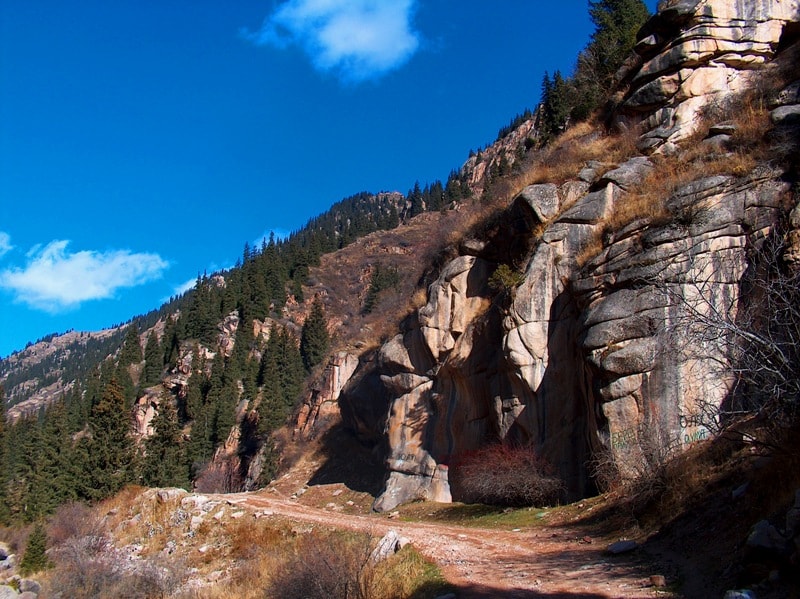
Gorge Grigoryevskoe.


Kyrgyzstan backcountry skiing.
“Nature does nothing in vain”
Aristotle.
Equine tourism in Kyrgyzstan.
Gorge Chon Ак-Суу or Grigoryevskoe begins on the south behind settlement Grigorevka. From the town of Cholpon-Ata up to the First lake of 56 kilometers, from the town of Balykchi prior to the beginning of gorge approximately 110 kilometers.
Length of a valley of the river Chon-Aksu from settlement Grigorevka prior to the beginning of rise on pass Aksu which is at height of 4012 meters above sea level, approximately 38 kilometers.
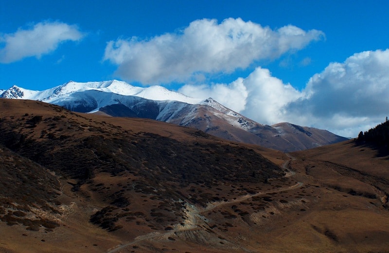
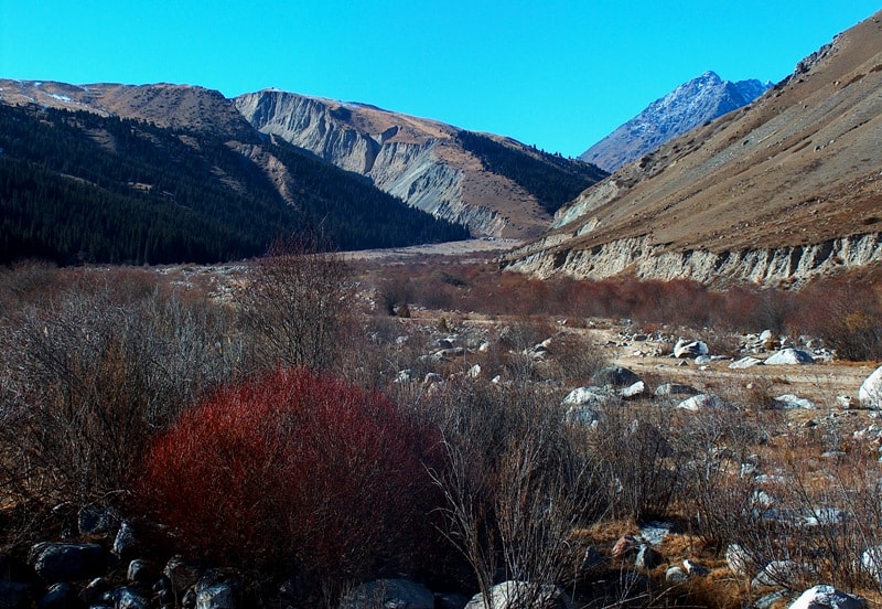
On northern slopes dense fir forests in comparison with southern slopes grow. This the most wonderful and picturesque the natural sight of southern spurs of mountain ridge Kungey Ala-Too.
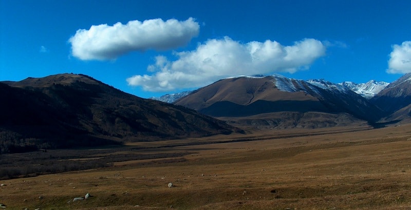
Valley Chon-Aksu passes from settlement Grigorevka in the beginning in a southern direction and there where on the east the highway on pass Kek-Bel in gorge Semenovskoe leaves, turns on the West.
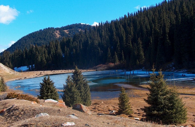
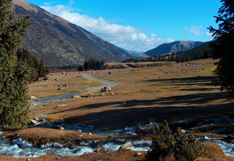
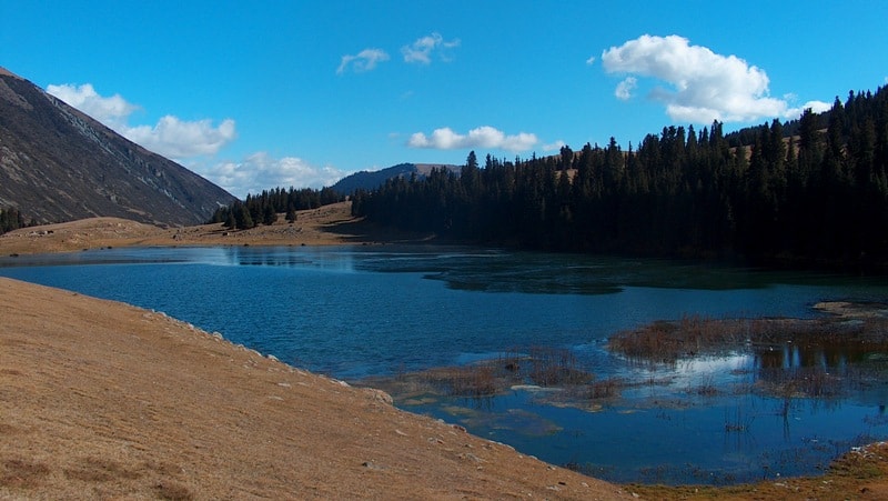
On a bottom of gorge one of the pure rivers Northern Tien-Shan - the river Chon-Aksu proceeds. In gorge Grigorevskom grow beautiful Tien-Shan fur-trees - endemic Tien-Shan. In gorge Grigorevskom two high-mountainous lakes are located.
In an average part of gorge the First lake (or lake Chon-Aksu) to which the highway conducts is located and above where the highway comes to an end the Second lake (or the Top lake) is located.
To tell what of them beautiful and picturesque it is inconvenient. After the Top lake, approximately, through 3 kilometers the zone of a wood in gorge comes to an end. In an average part of gorge there are two snow tops - Kum-Bel in height of 4200 meters above sea level and in a southern part of gorge, is closer to Chilik-Kemin to the crosspiece, there is peak Eshenbulak in height of 4647 meters above sea level in basic southern ridge Kungey Ala-Too on border with Kazakhstan.
From gorge Chon-Aksu on pass Ak-Su in height of 4012 meters the tourist track in a valley of the river Chong-Kemin to the most beautiful lake Northern Tien-Shan - to lake Zhasyl-Kol and further through pass Lake in height of 3507 meters above sea level in Almaty above sea level conducts.
This tourist route was popular and classical, approximately, up to 2004 - 2005 when transitions outside of check items through border of Kyrgyzstan and Kazakhstan were forbidden by boundary service of both countries.
Authority and photo:
Alexander Petrov.