


You are here
Alakol Natural reserve.
Sights Alakol reserve.
«Nature does nothing without purpose or uselessly»
Aristotle.
Tours Alakol Natural reserve.
Alakol State Nature Reserve was organized in accordance with Decree of Government of Republic of Kazakhstan dated April 21, 1998 No. 355 on territory of Alakol district in north of Zhetysu region and Urdzhar district of East Kazakhstan region.
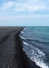
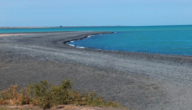
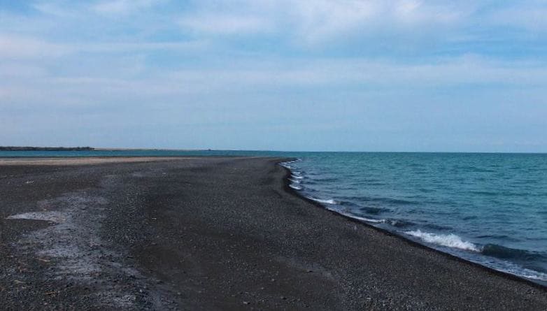
The reserve consists of two parts, the first of which is located in the delta of the Tentek River on the southern coast of Lake Sasykkol, the second is on the islands of Lake Alakol and is respectively 40 and 70 kilometers away from the city of Usharal.
The central estate of the reserve is located in the city of Usharal, Alakol district, Zhetysu region, which is 282 kilometers from the regional center of Taldykorgan, 582 kilometers from the city of Almaty and 510 kilometers from the city of Ust-Kamenogorsk.
Thus, the current area of the reserve is 20,743 hectares, including in the delta of the Tentek River (17,423 hectares) and on the islands of Lake Alakol (3,320 hectares). Within the Zhetysu region there are 18,453 hectares of protected area, the East Kazakhstan region - 2290 hectares.
Territory of Alakol Nature Reserve is divided into 7 bypasses:
“Togyztubek” (46°25’N, 81°08’E) in the eastern part of the Tentek delta covers the territory from the Batpakzhol tract to the Miyaly tract, with a total area of 3798 hectares;
“Tuyyksu” (46°23’N, 81°05’E) is located in the southeastern part of the Tentek delta between the Miyaly and Bashik tracts on an area of 3033 hectares;
“Kokpekty” (46°18’N, 80°69’E) in the southern part of the delta between the Bashik tract and the Tentek River on an area of 1376 hectares;
“Shiryaev” with an area of 3854 hectares is located around Shiryaev Island;
“Baibala” (46°27’N, 80°57’E) in the western part of the delta covers the territory from the right bank of the river. Tentek to the lake Baibal inclusive on an area of 3064 hectares;
“Karamoyn” (46° 28’ N, 80° 54’ E) is located in the western part of the Tentek delta between lakes Baibala and Sasykkol, including Karamoyn, on an area of 2298 hectares;
"Relict Gull" includes 3 islands in the northeastern part of Lake Alakol, Ulken Araltobe (46°11'N, 81°47'E), Sredniy (46°07'N, 81° 51'E), Kishkin Araltobe (46°06'N, 81°53'E), with a total area of 3320 hectares.
Each of them is assigned 1 - 2 security inspectors. The central estate is connected to the regional center and Almaty by the Almaty-Ust-Kamenogorsk highway and bus service. The Almaty – Aktogay – Dostyk railway also passes by Usharal with a stop at Beskol station (15 kilometers east of the city of Usharal).
The existing civil airport west of the city of Usharal has been inactive for more than 15 years. The protected area in the Tentek delta is connected to the central estate by field dirt roads with a length of 30 - 40 kilometers, travel along which in the spring and autumn is complicated during snowmelt and rain due to the soaking of the saline soil.
In May-June, access to the reserve is also limited due to high water on the Tentek River, and in snowy winters - due to snow covering them. Departure to the islands is carried out from the villages of Kamyskala and Akshi, with which the central estate is connected by asphalt roads with a length of 60 kilometers.
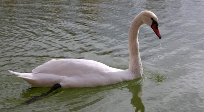
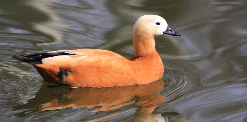
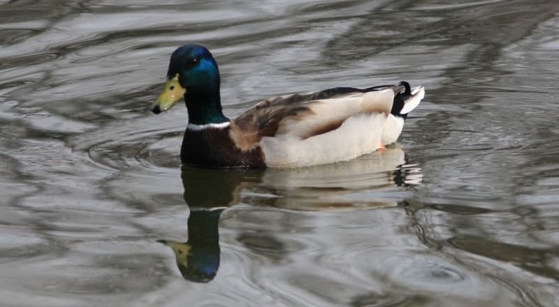
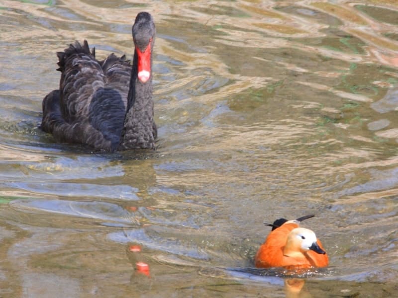
Trips to the islands are carried out by motor boats and cutters and are greatly complicated by frequent storms on Alakol during the entire navigation period. The islands are not visited in winter. Legal status and history of creation. After being located in 1968 and 1969 on Lake Alakol, the world's first unique colony of relict gulls (Auezov, 1970), ornithologists from the Institute of Zoology of the Academy of Sciences of the Kazakh SSR raised the question of the need to reserve Sredniy Island.
The petition was supported by a number of scientific institutions and public organizations of the Soviet Union, including the Zoological Institute of the USSR Academy of Sciences, the Central Laboratory of Nature Conservation of the USSR Ministry of Agriculture, and the Kazakh Society for Nature Conservation (Kovshar, 1977).
The Ornithology Laboratory of the Institute of Zoology of the Academy of Sciences of the Kazakh SSR developed recommendations for the creation of a special reserve on the island. Middle, which is the main nesting site relict gull. Considering the important scientific and cultural significance of colonial settlements of rare and endangered bird species on the Alakol Islands.
The Main Directorate of Nature Reserves and Hunting under the Council of Ministers of the Kazakh SSR, by order 211 of July 27, 1971, declared the islands of Sredniy, Ulken Araltobe (Bolshoy Kamenny) and Kishkin Araltobe (Small Kamenny) as the Alakol state reserve “Relict Seagull” of regional significance, prohibiting it from August 1 1971 visiting the islands without special permits and a staff of two rangers was established.
Later, when, as a result of a sharp drop in water level and cases of disturbance, a colony of relict gulls left Sredny Island in 1975 and moved to the western corner of the lake. Alakol to the Chubar-Tubek group of islands (Sandy, Southern). The Executive Committee of the Taldy-Kurgan Regional Council of Workers' Deputies, accepting the recommendations of ornithologists from the Institute of Zoology of the Academy of Sciences of the Kazakh SSR, by its decision No. 376 of September 13, 1977, expanded the area of the reserve, which included the islands of the Chubar-Tubek tract, on which there were colonies of relict gulls and black-headed gulls Khokhotunov.
By Resolution of the Council of Ministers of the Kazakh SSR dated September 5, 1978 No. 348, it was transformed into a state reserve of republican significance “Relic Seagull”. The regulations on the Relict Gull reserve were approved on February 8, 1987.
It was departmentally subordinate to the Main Directorate of Nature Reserves and Hunting under the Council of Ministers of the KazSSR. By order of the Minister of Forestry of the Kazakh SSR No. 191 dated December 20, 1988, the reserve with an area of 29.5 hectares was included in the Alakol Forestry Production Enterprise (ALPE) and the bird colonies on the islands were practically not protected since 1992.
In 1993, it was transferred to the jurisdiction of the Taldy-Kurgan Regional Inspectorate for the Protection of Wildlife. As a result of the subsequent series of reorganizations of the environmental system in Kazakhstan and the lack of funding, the world-famous reserve “Relict Seagull” essentially ceased to exist (Berezovikov, 2004).
The idea of creating a reserve on Alakol in the scientific community has existed for a long time. The organization of the reserve was recommended by the All-Russian Scientific Research Institute of Nature of the USSR Ministry of Agriculture and the Academy of Sciences of the Kazakh SSR back in 1980. According to the original plan, the Alakol Reserve with an area of 120,000 hectares was planned to be organized on an area that should cover the delta of the Tentek River, the eastern coast of Lake Sasykkol, the northwestern coast of Lake Uyaly ( Koshkarkol), a swampy isthmus between these lakes, as well as the islands of Lake Alakol.
The creation of the reserve was planned for 1986, but for a number of reasons it was repeatedly postponed, although all materials for the feasibility study were ready. According to the resolution of the Government of the Republic of Kazakhstan dated July 14, 1993.
“On measures for the development of state reserves and national parks in the Republic of Kazakhstan until 2005” Among the 5 reserves and 1 national park subject to priority organization was the Alakol Reserve. Only on March 13, 1996, to speed up the solution to the issue of organizing the reserve, on the initiative of the Taldykorgan Regional Department of Ecology and Bioresources, a temporary executive directorate of the Alakol Reserve was created (headed by S.A. Tolganbaev), whose activities were financed from the local nature conservation fund.
In connection with the reorganization of the Taldykorgan region and its inclusion in 1997 into the Almaty region, funding for the temporary administration ceased in January 1998. Officially, the Alakol State Nature Reserve was organized by Decree of the Government of the Republic of Kazakhstan dated April 21, 1998 No. 355 on an area of 12,520 hectares and includes part of the Tentek River delta on Lake Sasykkol and the islands of Lake Alakol (Middle, Ulken Araltobe,
ishken Araltobe). By the time the land plot was received in accordance with the decree of the government of the Republic of Kazakhstan, all state farms in the Tentek delta had already collapsed by 1998.
The most important nesting places for birds, especially Baybala, Karamoyyn and Chagyrly, which previously belonged to the liquidated Koopzveropromkhoz, remained vacant. In order to preserve the wetlands of the entire Tentek delta as a single ecosystem, additional land management was carried out in 1998 and documentation was prepared for expanding the territory of the reserve.
By decision of the akim of the Alakol district of the Almaty region 1 - 13 of January 19, 1999 “On the provision of a land plot to the Alakol state natural reserve from state land reserve lands” an additional land plot was provided in the western part of the Tentek delta on lakes Baibala and Karamoyn with an area of 17422.9 hectares, in including 146 hectares of hayfields, 540 hectares under bushes, 1986 hectares under water, 13788.9 hectares under swamps, 12 hectares under roads, 950 hectares of other lands.
The total area of the reserve in 1999 was 21,973 hectares. According to the decision of the akim of the Alakol region dated April 2, 1999 “On the withdrawal reserve" along the external borders of the reserve in the Tentek delta, a protective zone with an area of 21,547 hectares was created, and around the islands on Lake Alakol - a 500-meter protective zone.
By decision of the akim of the Alakol region dated April 2, 1999 1 - 97, a 2-kilometer protective zone with an area of 21,547 hectares was allocated around the reserve in the Tentek delta, including 4,400 hectares of the water area of Lake Sasykkol. The territory of the Alakol Nature Reserve adjoins the lands of the Alakol Forestry and Hunting Estate and 4 peasant farms located within the protected zone.
By decision of the akim of the East Kazakhstan region 948 of November 17, 2000 around the protected islands of Ulken Araltobe, Sredniy and Kishkene Araltobe on lake. Alakol has created a two-kilometer buffer zone with an area of 5,130 hectares, within which all hunting, installation of nets and other fishing gear, parking of boats, boats and other watercraft are prohibited within 500 meters from the border of the reserve.
The individual regulations on its regime were approved by the akim of the Urjar district of the East Kazakhstan region on July 15, 2001. Since 1998, the reserve has been departmentally subordinate to the Committee of Forestry, Fishing and Hunting of the Ministry of Agriculture of the Republic of Kazakhstan, since October 1999.
The Ministry of Natural Resources and Environmental Protection, whose structure includes the specified committee. In accordance with the Decree of the Government of the Republic of Kazakhstan dated October 7, 2002 No. 1096, the Committee for Forestry, Fishing and Hunting was transferred to the Ministry of Agriculture of the Republic of Kazakhstan.
Geographic coordinates of Alakol Nature Reserve: N46°21'17 E81°27'14

Authority:
Berezovikov Nikolay Nikolaevich, Candidate of Biological Sciences.
Photos by:
Alexander Petrov.